You are here: Home > Network List > CI - Caltech Regional Seismic Network Stations List
> Station DAN Danby, California, USA > Earthquake Result Viewer
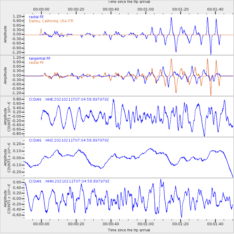
DAN Danby, California, USA - Earthquake Result Viewer
*The percent match for this event was below the threshold and hence no stack was calculated.
| Earthquake location: |
Southeast Of Loyalty Islands |
| Earthquake latitude/longitude: |
-23.3/171.7 |
| Earthquake time(UTC): |
2021/02/11 (042) 06:52:30 GMT |
| Earthquake Depth: |
10 km |
| Earthquake Magnitude: |
6.0 Mww |
| Earthquake Catalog/Contributor: |
NEIC PDE/us |
|
| Network: |
CI Caltech Regional Seismic Network |
| Station: |
DAN Danby, California, USA |
| Lat/Lon: |
34.64 N/115.38 W |
| Elevation: |
398 m |
|
| Distance: |
90.0 deg |
| Az: |
52.01 deg |
| Baz: |
241.495 deg |
| Ray Param: |
$rayparam |
*The percent match for this event was below the threshold and hence was not used in the summary stack. |
|
| Radial Match: |
29.123068 % |
| Radial Bump: |
400 |
| Transverse Match: |
28.079094 % |
| Transverse Bump: |
400 |
| SOD ConfigId: |
23341671 |
| Insert Time: |
2021-02-25 07:59:09.631 +0000 |
| GWidth: |
2.5 |
| Max Bumps: |
400 |
| Tol: |
0.001 |
|
Signal To Noise
| Channel | StoN | STA | LTA |
| CI:DAN: :HHZ:20210211T07:04:58.897979Z | 1.5483928 | 1.1915479E-7 | 7.695385E-8 |
| CI:DAN: :HHN:20210211T07:04:58.897979Z | 0.97399056 | 2.8166116E-7 | 2.8918262E-7 |
| CI:DAN: :HHE:20210211T07:04:58.897979Z | 0.49727282 | 1.5055738E-7 | 3.0276618E-7 |
| Arrivals |
| Ps | |
| PpPs | |
| PsPs/PpSs | |


