You are here: Home > Network List > AV - Alaska Volcano Observatory Stations List
> Station MAPS Pakushin Southeast, Makushin Volcano, Alaska > Earthquake Result Viewer
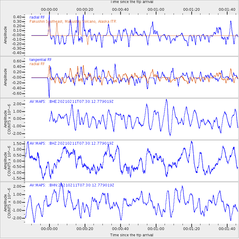
MAPS Pakushin Southeast, Makushin Volcano, Alaska - Earthquake Result Viewer
*The percent match for this event was below the threshold and hence no stack was calculated.
| Earthquake location: |
Southeast Of Loyalty Islands |
| Earthquake latitude/longitude: |
-23.3/171.9 |
| Earthquake time(UTC): |
2021/02/11 (042) 07:18:40 GMT |
| Earthquake Depth: |
10 km |
| Earthquake Magnitude: |
5.5 Mww |
| Earthquake Catalog/Contributor: |
NEIC PDE/us |
|
| Network: |
AV Alaska Volcano Observatory |
| Station: |
MAPS Pakushin Southeast, Makushin Volcano, Alaska |
| Lat/Lon: |
53.81 N/166.94 W |
| Elevation: |
333 m |
|
| Distance: |
78.9 deg |
| Az: |
12.591 deg |
| Baz: |
199.754 deg |
| Ray Param: |
$rayparam |
*The percent match for this event was below the threshold and hence was not used in the summary stack. |
|
| Radial Match: |
62.691853 % |
| Radial Bump: |
400 |
| Transverse Match: |
61.992023 % |
| Transverse Bump: |
400 |
| SOD ConfigId: |
23341671 |
| Insert Time: |
2021-02-25 08:23:34.521 +0000 |
| GWidth: |
2.5 |
| Max Bumps: |
400 |
| Tol: |
0.001 |
|
Signal To Noise
| Channel | StoN | STA | LTA |
| AV:MAPS: :BHZ:20210211T07:30:12.779019Z | 1.3656851 | 8.517238E-7 | 6.2366047E-7 |
| AV:MAPS: :BHN:20210211T07:30:12.779019Z | 1.057478 | 1.0933221E-6 | 1.033896E-6 |
| AV:MAPS: :BHE:20210211T07:30:12.779019Z | 1.115767 | 7.53346E-7 | 6.751822E-7 |
| Arrivals |
| Ps | |
| PpPs | |
| PsPs/PpSs | |


