You are here: Home > Network List > TA - USArray Transportable Network (new EarthScope stations) Stations List
> Station O17K Koliganek, Bristol Bay, AK, USA > Earthquake Result Viewer
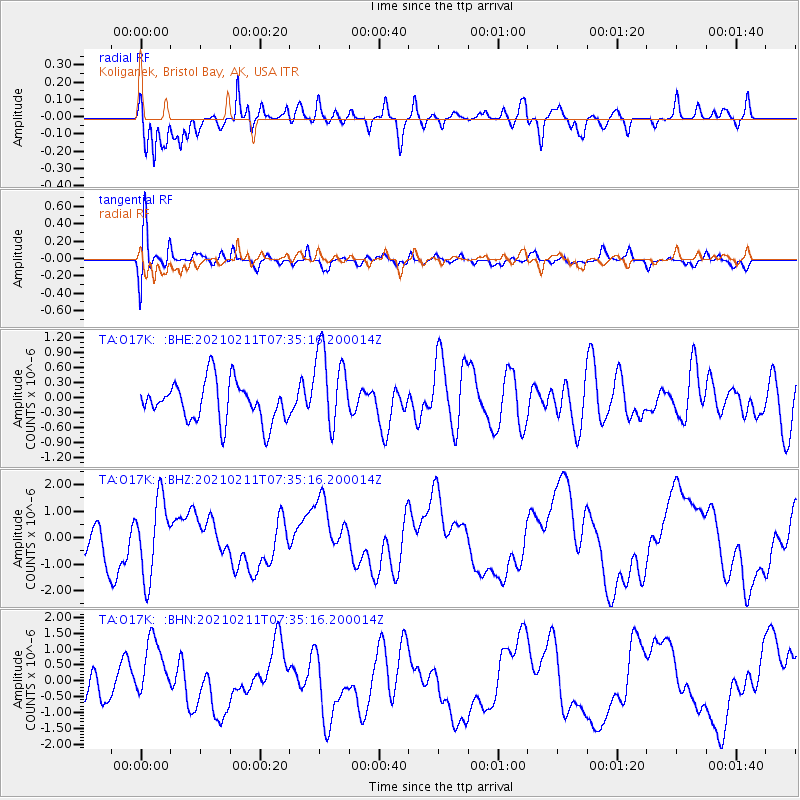
O17K Koliganek, Bristol Bay, AK, USA - Earthquake Result Viewer
*The percent match for this event was below the threshold and hence no stack was calculated.
| Earthquake location: |
Southeast Of Loyalty Islands |
| Earthquake latitude/longitude: |
-22.8/171.8 |
| Earthquake time(UTC): |
2021/02/11 (042) 07:23:06 GMT |
| Earthquake Depth: |
10 km |
| Earthquake Magnitude: |
5.5 mb |
| Earthquake Catalog/Contributor: |
NEIC PDE/us |
|
| Network: |
TA USArray Transportable Network (new EarthScope stations) |
| Station: |
O17K Koliganek, Bristol Bay, AK, USA |
| Lat/Lon: |
59.77 N/157.09 W |
| Elevation: |
156 m |
|
| Distance: |
86.2 deg |
| Az: |
15.185 deg |
| Baz: |
208.528 deg |
| Ray Param: |
$rayparam |
*The percent match for this event was below the threshold and hence was not used in the summary stack. |
|
| Radial Match: |
85.724976 % |
| Radial Bump: |
336 |
| Transverse Match: |
75.710396 % |
| Transverse Bump: |
400 |
| SOD ConfigId: |
23341671 |
| Insert Time: |
2021-02-25 08:42:16.355 +0000 |
| GWidth: |
2.5 |
| Max Bumps: |
400 |
| Tol: |
0.001 |
|
Signal To Noise
| Channel | StoN | STA | LTA |
| TA:O17K: :BHZ:20210211T07:35:16.200014Z | 2.0885801 | 1.4560597E-6 | 6.97153E-7 |
| TA:O17K: :BHN:20210211T07:35:16.200014Z | 1.7906793 | 1.0282308E-6 | 5.742127E-7 |
| TA:O17K: :BHE:20210211T07:35:16.200014Z | 2.052969 | 8.2229326E-7 | 4.0053857E-7 |
| Arrivals |
| Ps | |
| PpPs | |
| PsPs/PpSs | |


