You are here: Home > Network List > UU - University of Utah Regional Network Stations List
> Station CCUT Cedar City, UT, USA > Earthquake Result Viewer
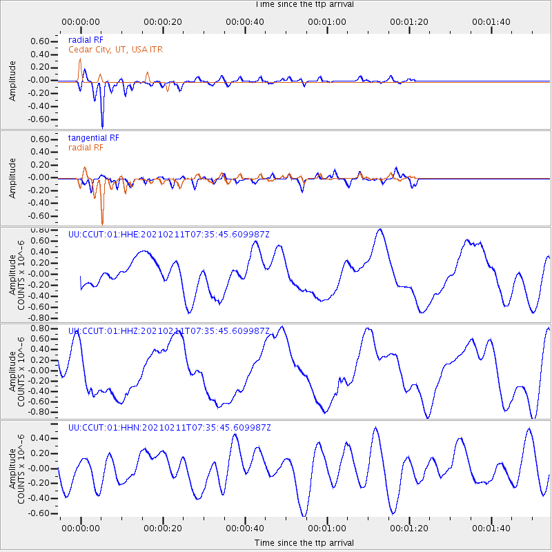
CCUT Cedar City, UT, USA - Earthquake Result Viewer
*The percent match for this event was below the threshold and hence no stack was calculated.
| Earthquake location: |
Southeast Of Loyalty Islands |
| Earthquake latitude/longitude: |
-22.8/171.8 |
| Earthquake time(UTC): |
2021/02/11 (042) 07:23:06 GMT |
| Earthquake Depth: |
10 km |
| Earthquake Magnitude: |
5.5 mb |
| Earthquake Catalog/Contributor: |
NEIC PDE/us |
|
| Network: |
UU University of Utah Regional Network |
| Station: |
CCUT Cedar City, UT, USA |
| Lat/Lon: |
37.55 N/113.36 W |
| Elevation: |
2127 m |
|
| Distance: |
92.4 deg |
| Az: |
50.157 deg |
| Baz: |
243.017 deg |
| Ray Param: |
$rayparam |
*The percent match for this event was below the threshold and hence was not used in the summary stack. |
|
| Radial Match: |
86.42849 % |
| Radial Bump: |
330 |
| Transverse Match: |
51.640938 % |
| Transverse Bump: |
332 |
| SOD ConfigId: |
23341671 |
| Insert Time: |
2021-02-25 08:43:28.014 +0000 |
| GWidth: |
2.5 |
| Max Bumps: |
400 |
| Tol: |
0.001 |
|
Signal To Noise
| Channel | StoN | STA | LTA |
| UU:CCUT:01:HHZ:20210211T07:35:45.609987Z | 1.0678163 | 4.5336083E-7 | 4.245682E-7 |
| UU:CCUT:01:HHN:20210211T07:35:45.609987Z | 0.8698125 | 2.0411956E-7 | 2.3467076E-7 |
| UU:CCUT:01:HHE:20210211T07:35:45.609987Z | 2.0344503 | 4.0887454E-7 | 2.0097544E-7 |
| Arrivals |
| Ps | |
| PpPs | |
| PsPs/PpSs | |


