You are here: Home > Network List > AZ - ANZA Regional Network Stations List
> Station SMER AZ.SMER > Earthquake Result Viewer
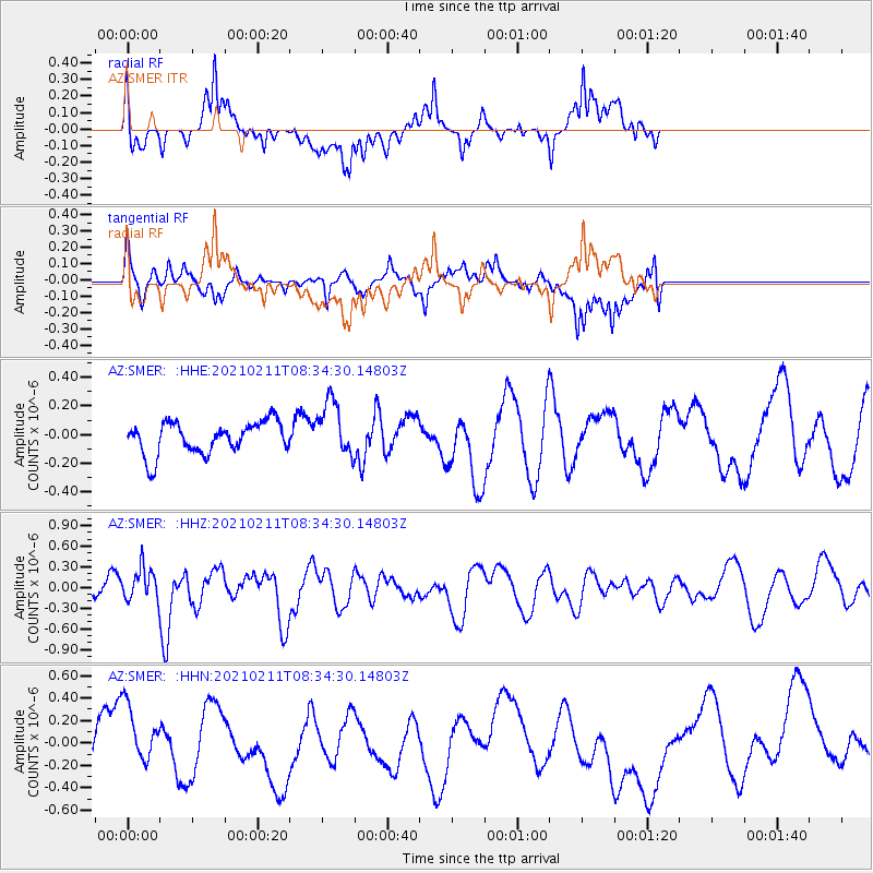
SMER AZ.SMER - Earthquake Result Viewer
*The percent match for this event was below the threshold and hence no stack was calculated.
| Earthquake location: |
Southeast Of Loyalty Islands |
| Earthquake latitude/longitude: |
-22.9/171.2 |
| Earthquake time(UTC): |
2021/02/11 (042) 08:22:10 GMT |
| Earthquake Depth: |
10 km |
| Earthquake Magnitude: |
5.9 mww |
| Earthquake Catalog/Contributor: |
NEIC PDE/us |
|
| Network: |
AZ ANZA Regional Network |
| Station: |
SMER AZ.SMER |
| Lat/Lon: |
33.46 N/117.17 W |
| Elevation: |
355 m |
|
| Distance: |
88.2 deg |
| Az: |
52.523 deg |
| Baz: |
241.119 deg |
| Ray Param: |
$rayparam |
*The percent match for this event was below the threshold and hence was not used in the summary stack. |
|
| Radial Match: |
67.56841 % |
| Radial Bump: |
400 |
| Transverse Match: |
57.99801 % |
| Transverse Bump: |
400 |
| SOD ConfigId: |
23341671 |
| Insert Time: |
2021-02-25 09:26:22.132 +0000 |
| GWidth: |
2.5 |
| Max Bumps: |
400 |
| Tol: |
0.001 |
|
Signal To Noise
| Channel | StoN | STA | LTA |
| AZ:SMER: :HHZ:20210211T08:34:30.14803Z | 1.7467006 | 2.423996E-7 | 1.387757E-7 |
| AZ:SMER: :HHN:20210211T08:34:30.14803Z | 1.4328532 | 2.7941022E-7 | 1.9500268E-7 |
| AZ:SMER: :HHE:20210211T08:34:30.14803Z | 1.7227118 | 1.9236171E-7 | 1.1166215E-7 |
| Arrivals |
| Ps | |
| PpPs | |
| PsPs/PpSs | |


