You are here: Home > Network List > CI - Caltech Regional Seismic Network Stations List
> Station TIN Tinemaha, Big Pine, CA, USA > Earthquake Result Viewer
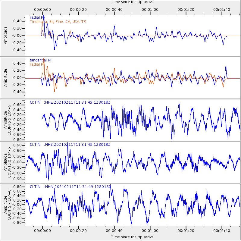
TIN Tinemaha, Big Pine, CA, USA - Earthquake Result Viewer
*The percent match for this event was below the threshold and hence no stack was calculated.
| Earthquake location: |
Southeast Of Loyalty Islands |
| Earthquake latitude/longitude: |
-23.1/172.0 |
| Earthquake time(UTC): |
2021/02/11 (042) 11:19:26 GMT |
| Earthquake Depth: |
10 km |
| Earthquake Magnitude: |
5.6 mb |
| Earthquake Catalog/Contributor: |
NEIC PDE/us |
|
| Network: |
CI Caltech Regional Seismic Network |
| Station: |
TIN Tinemaha, Big Pine, CA, USA |
| Lat/Lon: |
37.05 N/118.23 W |
| Elevation: |
1197 m |
|
| Distance: |
88.8 deg |
| Az: |
48.655 deg |
| Baz: |
239.777 deg |
| Ray Param: |
$rayparam |
*The percent match for this event was below the threshold and hence was not used in the summary stack. |
|
| Radial Match: |
72.134926 % |
| Radial Bump: |
400 |
| Transverse Match: |
30.42203 % |
| Transverse Bump: |
400 |
| SOD ConfigId: |
23341671 |
| Insert Time: |
2021-02-25 12:25:43.752 +0000 |
| GWidth: |
2.5 |
| Max Bumps: |
400 |
| Tol: |
0.001 |
|
Signal To Noise
| Channel | StoN | STA | LTA |
| CI:TIN: :HHZ:20210211T11:31:49.128018Z | 2.1931539 | 4.0432653E-7 | 1.8435848E-7 |
| CI:TIN: :HHN:20210211T11:31:49.128018Z | 1.2010052 | 3.229446E-7 | 2.6889526E-7 |
| CI:TIN: :HHE:20210211T11:31:49.128018Z | 1.1063131 | 2.329787E-7 | 2.105902E-7 |
| Arrivals |
| Ps | |
| PpPs | |
| PsPs/PpSs | |


