You are here: Home > Network List > US - United States National Seismic Network Stations List
> Station WUAZ Wupatki, Arizona, USA > Earthquake Result Viewer
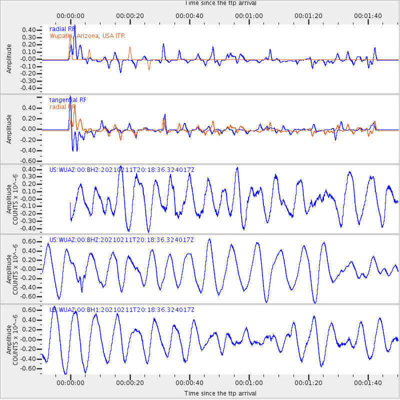
WUAZ Wupatki, Arizona, USA - Earthquake Result Viewer
*The percent match for this event was below the threshold and hence no stack was calculated.
| Earthquake location: |
Southeast Of Loyalty Islands |
| Earthquake latitude/longitude: |
-22.6/171.2 |
| Earthquake time(UTC): |
2021/02/11 (042) 20:05:53 GMT |
| Earthquake Depth: |
10 km |
| Earthquake Magnitude: |
5.2 Mww |
| Earthquake Catalog/Contributor: |
NEIC PDE/us |
|
| Network: |
US United States National Seismic Network |
| Station: |
WUAZ Wupatki, Arizona, USA |
| Lat/Lon: |
35.52 N/111.37 W |
| Elevation: |
1592 m |
|
| Distance: |
93.3 deg |
| Az: |
52.892 deg |
| Baz: |
244.6 deg |
| Ray Param: |
$rayparam |
*The percent match for this event was below the threshold and hence was not used in the summary stack. |
|
| Radial Match: |
73.320305 % |
| Radial Bump: |
400 |
| Transverse Match: |
58.05555 % |
| Transverse Bump: |
400 |
| SOD ConfigId: |
23341671 |
| Insert Time: |
2021-02-25 21:18:13.191 +0000 |
| GWidth: |
2.5 |
| Max Bumps: |
400 |
| Tol: |
0.001 |
|
Signal To Noise
| Channel | StoN | STA | LTA |
| US:WUAZ:00:BHZ:20210211T20:18:36.324017Z | 0.61977786 | 2.436822E-7 | 3.9317666E-7 |
| US:WUAZ:00:BH1:20210211T20:18:36.324017Z | 1.5360583 | 4.3101826E-7 | 2.806002E-7 |
| US:WUAZ:00:BH2:20210211T20:18:36.324017Z | 0.8254005 | 1.661805E-7 | 2.0133317E-7 |
| Arrivals |
| Ps | |
| PpPs | |
| PsPs/PpSs | |


