
ARA XW.ARA - Earthquake Result Viewer
| ||||||||||||||||||
| ||||||||||||||||||
| ||||||||||||||||||
|
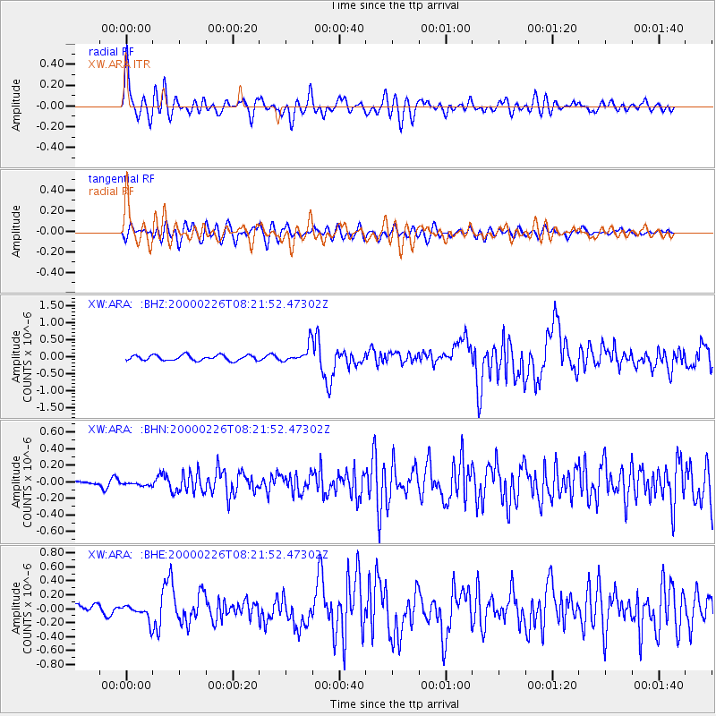
Signal To Noise
| Channel | StoN | STA | LTA |
| XW:ARA: :BHN:20000226T08:21:52.47302Z | 0.45206296 | 2.2648756E-8 | 5.0100887E-8 |
| XW:ARA: :BHE:20000226T08:21:52.47302Z | 2.6210127 | 1.187457E-7 | 4.5305278E-8 |
| XW:ARA: :BHZ:20000226T08:21:52.47302Z | 3.3799443 | 2.6207303E-7 | 7.753768E-8 |
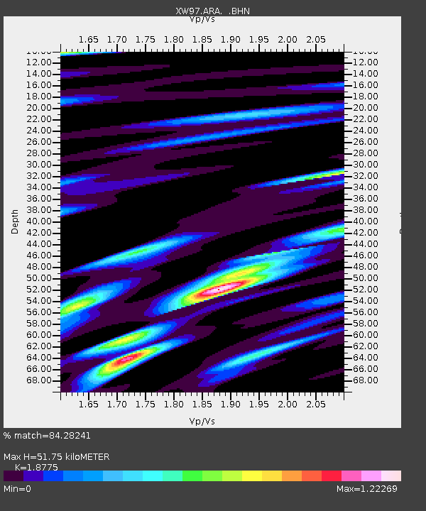
| Arrivals | |
| Ps | 7.3 SECOND |
| PpPs | 22 SECOND |
| PsPs/PpSs | 29 SECOND |

