You are here: Home > Network List > IU - Global Seismograph Network (GSN - IRIS/USGS) Stations List
> Station PMG Port Moresby, New Guinea > Earthquake Result Viewer
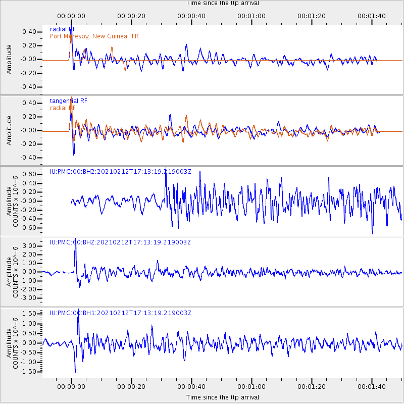
PMG Port Moresby, New Guinea - Earthquake Result Viewer
*The percent match for this event was below the threshold and hence no stack was calculated.
| Earthquake location: |
Tajikistan-Xinjiang Border Reg. |
| Earthquake latitude/longitude: |
38.1/73.6 |
| Earthquake time(UTC): |
2021/02/12 (043) 17:01:34 GMT |
| Earthquake Depth: |
92 km |
| Earthquake Magnitude: |
5.9 Mww |
| Earthquake Catalog/Contributor: |
NEIC PDE/us |
|
| Network: |
IU Global Seismograph Network (GSN - IRIS/USGS) |
| Station: |
PMG Port Moresby, New Guinea |
| Lat/Lon: |
9.40 S/147.16 E |
| Elevation: |
90 m |
|
| Distance: |
83.1 deg |
| Az: |
107.554 deg |
| Baz: |
310.36 deg |
| Ray Param: |
$rayparam |
*The percent match for this event was below the threshold and hence was not used in the summary stack. |
|
| Radial Match: |
77.526344 % |
| Radial Bump: |
400 |
| Transverse Match: |
75.285484 % |
| Transverse Bump: |
400 |
| SOD ConfigId: |
23341671 |
| Insert Time: |
2021-02-26 18:11:41.264 +0000 |
| GWidth: |
2.5 |
| Max Bumps: |
400 |
| Tol: |
0.001 |
|
Signal To Noise
| Channel | StoN | STA | LTA |
| IU:PMG:00:BHZ:20210212T17:13:19.219003Z | 10.929338 | 1.1734668E-6 | 1.07368514E-7 |
| IU:PMG:00:BH1:20210212T17:13:19.219003Z | 5.918192 | 6.4709945E-7 | 1.0934073E-7 |
| IU:PMG:00:BH2:20210212T17:13:19.219003Z | 2.7037213 | 2.6880187E-7 | 9.941923E-8 |
| Arrivals |
| Ps | |
| PpPs | |
| PsPs/PpSs | |


