You are here: Home > Network List > TA - USArray Transportable Network (new EarthScope stations) Stations List
> Station A36M Sachs Harbour, NT, CAN > Earthquake Result Viewer
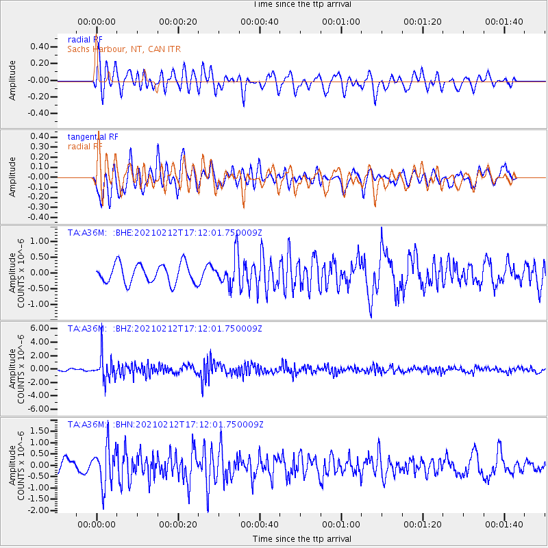
A36M Sachs Harbour, NT, CAN - Earthquake Result Viewer
*The percent match for this event was below the threshold and hence no stack was calculated.
| Earthquake location: |
Tajikistan-Xinjiang Border Reg. |
| Earthquake latitude/longitude: |
38.1/73.6 |
| Earthquake time(UTC): |
2021/02/12 (043) 17:01:34 GMT |
| Earthquake Depth: |
92 km |
| Earthquake Magnitude: |
5.9 Mww |
| Earthquake Catalog/Contributor: |
NEIC PDE/us |
|
| Network: |
TA USArray Transportable Network (new EarthScope stations) |
| Station: |
A36M Sachs Harbour, NT, CAN |
| Lat/Lon: |
71.99 N/125.25 W |
| Elevation: |
32 m |
|
| Distance: |
69.4 deg |
| Az: |
6.155 deg |
| Baz: |
344.231 deg |
| Ray Param: |
$rayparam |
*The percent match for this event was below the threshold and hence was not used in the summary stack. |
|
| Radial Match: |
68.49329 % |
| Radial Bump: |
400 |
| Transverse Match: |
69.97022 % |
| Transverse Bump: |
400 |
| SOD ConfigId: |
23341671 |
| Insert Time: |
2021-02-26 18:15:10.339 +0000 |
| GWidth: |
2.5 |
| Max Bumps: |
400 |
| Tol: |
0.001 |
|
Signal To Noise
| Channel | StoN | STA | LTA |
| TA:A36M: :BHZ:20210212T17:12:01.750009Z | 7.610204 | 1.8340464E-6 | 2.4099833E-7 |
| TA:A36M: :BHN:20210212T17:12:01.750009Z | 2.7166533 | 8.8233514E-7 | 3.2478752E-7 |
| TA:A36M: :BHE:20210212T17:12:01.750009Z | 1.6474922 | 5.050039E-7 | 3.0652888E-7 |
| Arrivals |
| Ps | |
| PpPs | |
| PsPs/PpSs | |


