You are here: Home > Network List > TA - USArray Transportable Network (new EarthScope stations) Stations List
> Station G16K Koyuk River, AK, USA > Earthquake Result Viewer
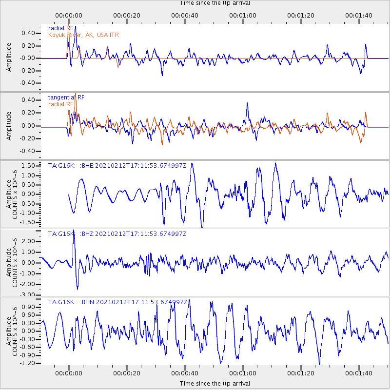
G16K Koyuk River, AK, USA - Earthquake Result Viewer
*The percent match for this event was below the threshold and hence no stack was calculated.
| Earthquake location: |
Tajikistan-Xinjiang Border Reg. |
| Earthquake latitude/longitude: |
38.1/73.6 |
| Earthquake time(UTC): |
2021/02/12 (043) 17:01:34 GMT |
| Earthquake Depth: |
92 km |
| Earthquake Magnitude: |
5.9 Mww |
| Earthquake Catalog/Contributor: |
NEIC PDE/us |
|
| Network: |
TA USArray Transportable Network (new EarthScope stations) |
| Station: |
G16K Koyuk River, AK, USA |
| Lat/Lon: |
65.39 N/162.35 W |
| Elevation: |
169 m |
|
| Distance: |
68.1 deg |
| Az: |
21.953 deg |
| Baz: |
315.241 deg |
| Ray Param: |
$rayparam |
*The percent match for this event was below the threshold and hence was not used in the summary stack. |
|
| Radial Match: |
68.8106 % |
| Radial Bump: |
400 |
| Transverse Match: |
48.18697 % |
| Transverse Bump: |
322 |
| SOD ConfigId: |
23341671 |
| Insert Time: |
2021-02-26 18:15:37.611 +0000 |
| GWidth: |
2.5 |
| Max Bumps: |
400 |
| Tol: |
0.001 |
|
Signal To Noise
| Channel | StoN | STA | LTA |
| TA:G16K: :BHZ:20210212T17:11:53.674997Z | 2.6072674 | 1.2120427E-6 | 4.6487085E-7 |
| TA:G16K: :BHN:20210212T17:11:53.674997Z | 1.1141891 | 3.874961E-7 | 3.4778304E-7 |
| TA:G16K: :BHE:20210212T17:11:53.674997Z | 1.4182739 | 5.96316E-7 | 4.2045195E-7 |
| Arrivals |
| Ps | |
| PpPs | |
| PsPs/PpSs | |


