You are here: Home > Network List > TA - USArray Transportable Network (new EarthScope stations) Stations List
> Station G31M Satah River, YT, CAN > Earthquake Result Viewer
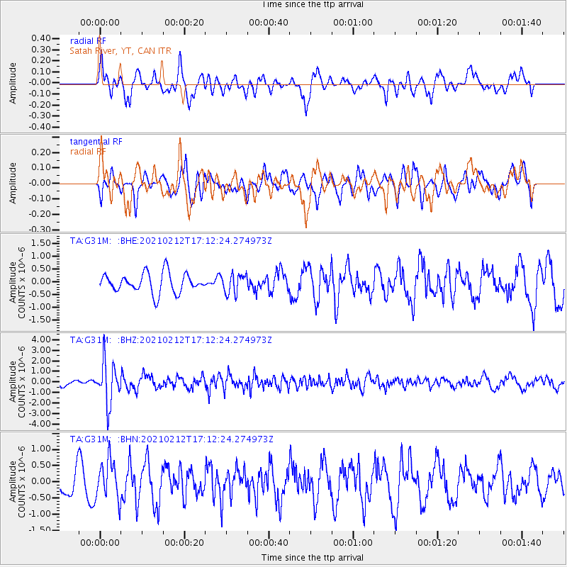
G31M Satah River, YT, CAN - Earthquake Result Viewer
*The percent match for this event was below the threshold and hence no stack was calculated.
| Earthquake location: |
Tajikistan-Xinjiang Border Reg. |
| Earthquake latitude/longitude: |
38.1/73.6 |
| Earthquake time(UTC): |
2021/02/12 (043) 17:01:34 GMT |
| Earthquake Depth: |
92 km |
| Earthquake Magnitude: |
5.9 Mww |
| Earthquake Catalog/Contributor: |
NEIC PDE/us |
|
| Network: |
TA USArray Transportable Network (new EarthScope stations) |
| Station: |
G31M Satah River, YT, CAN |
| Lat/Lon: |
66.92 N/134.27 W |
| Elevation: |
61 m |
|
| Distance: |
73.1 deg |
| Az: |
11.091 deg |
| Baz: |
337.366 deg |
| Ray Param: |
$rayparam |
*The percent match for this event was below the threshold and hence was not used in the summary stack. |
|
| Radial Match: |
54.48371 % |
| Radial Bump: |
400 |
| Transverse Match: |
47.074554 % |
| Transverse Bump: |
346 |
| SOD ConfigId: |
23341671 |
| Insert Time: |
2021-02-26 18:15:43.389 +0000 |
| GWidth: |
2.5 |
| Max Bumps: |
400 |
| Tol: |
0.001 |
|
Signal To Noise
| Channel | StoN | STA | LTA |
| TA:G31M: :BHZ:20210212T17:12:24.274973Z | 9.563245 | 1.9936053E-6 | 2.0846537E-7 |
| TA:G31M: :BHN:20210212T17:12:24.274973Z | 1.8783752 | 6.0547796E-7 | 3.2234132E-7 |
| TA:G31M: :BHE:20210212T17:12:24.274973Z | 0.9834172 | 3.791556E-7 | 3.855491E-7 |
| Arrivals |
| Ps | |
| PpPs | |
| PsPs/PpSs | |


