You are here: Home > Network List > US - United States National Seismic Network Stations List
> Station DGMT Dagmar, Montana, USA > Earthquake Result Viewer
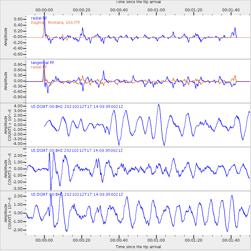
DGMT Dagmar, Montana, USA - Earthquake Result Viewer
*The percent match for this event was below the threshold and hence no stack was calculated.
| Earthquake location: |
Tajikistan-Xinjiang Border Reg. |
| Earthquake latitude/longitude: |
38.1/73.6 |
| Earthquake time(UTC): |
2021/02/12 (043) 17:01:34 GMT |
| Earthquake Depth: |
92 km |
| Earthquake Magnitude: |
5.9 Mww |
| Earthquake Catalog/Contributor: |
NEIC PDE/us |
|
| Network: |
US United States National Seismic Network |
| Station: |
DGMT Dagmar, Montana, USA |
| Lat/Lon: |
48.47 N/104.20 W |
| Elevation: |
0.0 m |
|
| Distance: |
93.8 deg |
| Az: |
358.509 deg |
| Baz: |
1.767 deg |
| Ray Param: |
$rayparam |
*The percent match for this event was below the threshold and hence was not used in the summary stack. |
|
| Radial Match: |
72.4961 % |
| Radial Bump: |
307 |
| Transverse Match: |
70.74469 % |
| Transverse Bump: |
337 |
| SOD ConfigId: |
23341671 |
| Insert Time: |
2021-02-26 18:17:16.029 +0000 |
| GWidth: |
2.5 |
| Max Bumps: |
400 |
| Tol: |
0.001 |
|
Signal To Noise
| Channel | StoN | STA | LTA |
| US:DGMT:00:BHZ:20210212T17:14:09.950021Z | 1.8842903 | 1.2514171E-6 | 6.641318E-7 |
| US:DGMT:00:BH1:20210212T17:14:09.950021Z | 1.1126329 | 8.248982E-7 | 7.41393E-7 |
| US:DGMT:00:BH2:20210212T17:14:09.950021Z | 0.81046146 | 7.421043E-7 | 9.1565647E-7 |
| Arrivals |
| Ps | |
| PpPs | |
| PsPs/PpSs | |


