You are here: Home > Network List > US - United States National Seismic Network Stations List
> Station WRAK Wrangell Island, Southeastern Alaska, Alaska, USA > Earthquake Result Viewer
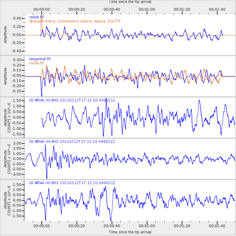
WRAK Wrangell Island, Southeastern Alaska, Alaska, USA - Earthquake Result Viewer
*The percent match for this event was below the threshold and hence no stack was calculated.
| Earthquake location: |
Tajikistan-Xinjiang Border Reg. |
| Earthquake latitude/longitude: |
38.1/73.6 |
| Earthquake time(UTC): |
2021/02/12 (043) 17:01:34 GMT |
| Earthquake Depth: |
92 km |
| Earthquake Magnitude: |
5.9 Mww |
| Earthquake Catalog/Contributor: |
NEIC PDE/us |
|
| Network: |
US United States National Seismic Network |
| Station: |
WRAK Wrangell Island, Southeastern Alaska, Alaska, USA |
| Lat/Lon: |
56.42 N/132.35 W |
| Elevation: |
81 m |
|
| Distance: |
83.3 deg |
| Az: |
14.155 deg |
| Baz: |
339.694 deg |
| Ray Param: |
$rayparam |
*The percent match for this event was below the threshold and hence was not used in the summary stack. |
|
| Radial Match: |
59.67924 % |
| Radial Bump: |
400 |
| Transverse Match: |
53.351295 % |
| Transverse Bump: |
400 |
| SOD ConfigId: |
23341671 |
| Insert Time: |
2021-02-26 18:17:26.453 +0000 |
| GWidth: |
2.5 |
| Max Bumps: |
400 |
| Tol: |
0.001 |
|
Signal To Noise
| Channel | StoN | STA | LTA |
| US:WRAK:00:BHZ:20210212T17:13:20.049021Z | 3.1753535 | 1.4748977E-6 | 4.64483E-7 |
| US:WRAK:00:BH1:20210212T17:13:20.049021Z | 1.9689939 | 7.5805906E-7 | 3.8499817E-7 |
| US:WRAK:00:BH2:20210212T17:13:20.049021Z | 0.9750447 | 4.4073704E-7 | 4.5201728E-7 |
| Arrivals |
| Ps | |
| PpPs | |
| PsPs/PpSs | |


