You are here: Home > Network List > TA - USArray Transportable Network (new EarthScope stations) Stations List
> Station A36M Sachs Harbour, NT, CAN > Earthquake Result Viewer
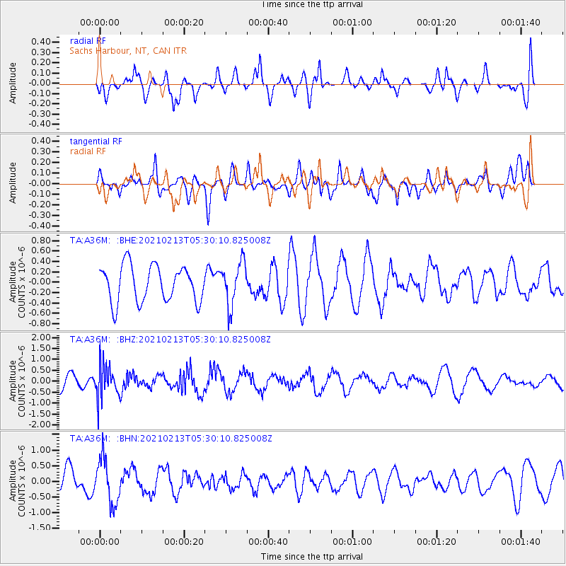
A36M Sachs Harbour, NT, CAN - Earthquake Result Viewer
*The percent match for this event was below the threshold and hence no stack was calculated.
| Earthquake location: |
Peru-Ecuador Border Region |
| Earthquake latitude/longitude: |
-4.1/-80.2 |
| Earthquake time(UTC): |
2021/02/13 (044) 05:18:33 GMT |
| Earthquake Depth: |
71 km |
| Earthquake Magnitude: |
5.3 Mww |
| Earthquake Catalog/Contributor: |
NEIC PDE/us |
|
| Network: |
TA USArray Transportable Network (new EarthScope stations) |
| Station: |
A36M Sachs Harbour, NT, CAN |
| Lat/Lon: |
71.99 N/125.25 W |
| Elevation: |
32 m |
|
| Distance: |
81.3 deg |
| Az: |
347.119 deg |
| Baz: |
134.379 deg |
| Ray Param: |
$rayparam |
*The percent match for this event was below the threshold and hence was not used in the summary stack. |
|
| Radial Match: |
42.403667 % |
| Radial Bump: |
400 |
| Transverse Match: |
57.28478 % |
| Transverse Bump: |
400 |
| SOD ConfigId: |
23341671 |
| Insert Time: |
2021-02-27 06:34:14.988 +0000 |
| GWidth: |
2.5 |
| Max Bumps: |
400 |
| Tol: |
0.001 |
|
Signal To Noise
| Channel | StoN | STA | LTA |
| TA:A36M: :BHZ:20210213T05:30:10.825008Z | 2.2155833 | 7.7548157E-7 | 3.5001236E-7 |
| TA:A36M: :BHN:20210213T05:30:10.825008Z | 2.1941612 | 7.3144867E-7 | 3.333614E-7 |
| TA:A36M: :BHE:20210213T05:30:10.825008Z | 1.215557 | 4.24017E-7 | 3.4882527E-7 |
| Arrivals |
| Ps | |
| PpPs | |
| PsPs/PpSs | |


