You are here: Home > Network List > CI - Caltech Regional Seismic Network Stations List
> Station SMM Simmler, CA, USA > Earthquake Result Viewer
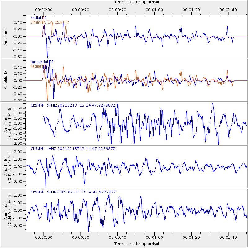
SMM Simmler, CA, USA - Earthquake Result Viewer
*The percent match for this event was below the threshold and hence no stack was calculated.
| Earthquake location: |
Alaska Peninsula |
| Earthquake latitude/longitude: |
57.1/-155.1 |
| Earthquake time(UTC): |
2021/02/13 (044) 13:08:55 GMT |
| Earthquake Depth: |
39 km |
| Earthquake Magnitude: |
5.3 Mww |
| Earthquake Catalog/Contributor: |
NEIC PDE/ak |
|
| Network: |
CI Caltech Regional Seismic Network |
| Station: |
SMM Simmler, CA, USA |
| Lat/Lon: |
35.31 N/120.00 W |
| Elevation: |
599 m |
|
| Distance: |
32.1 deg |
| Az: |
117.761 deg |
| Baz: |
323.832 deg |
| Ray Param: |
$rayparam |
*The percent match for this event was below the threshold and hence was not used in the summary stack. |
|
| Radial Match: |
69.43781 % |
| Radial Bump: |
400 |
| Transverse Match: |
63.684814 % |
| Transverse Bump: |
400 |
| SOD ConfigId: |
23341671 |
| Insert Time: |
2021-02-27 14:12:33.162 +0000 |
| GWidth: |
2.5 |
| Max Bumps: |
400 |
| Tol: |
0.001 |
|
Signal To Noise
| Channel | StoN | STA | LTA |
| CI:SMM: :HHZ:20210213T13:14:47.927987Z | 1.8198144 | 8.88773E-7 | 4.883866E-7 |
| CI:SMM: :HHN:20210213T13:14:47.927987Z | 1.5125974 | 7.221507E-7 | 4.7742424E-7 |
| CI:SMM: :HHE:20210213T13:14:47.927987Z | 1.854918 | 1.0753618E-6 | 5.7973546E-7 |
| Arrivals |
| Ps | |
| PpPs | |
| PsPs/PpSs | |


