You are here: Home > Network List > GS - US Geological Survey Networks Stations List
> Station DEC08 Union Local 159 Surface Site > Earthquake Result Viewer
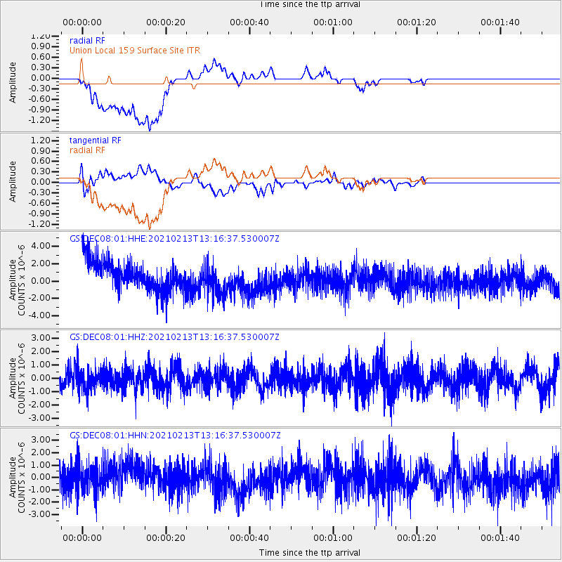
DEC08 Union Local 159 Surface Site - Earthquake Result Viewer
*The percent match for this event was below the threshold and hence no stack was calculated.
| Earthquake location: |
Alaska Peninsula |
| Earthquake latitude/longitude: |
57.1/-155.1 |
| Earthquake time(UTC): |
2021/02/13 (044) 13:08:55 GMT |
| Earthquake Depth: |
39 km |
| Earthquake Magnitude: |
5.3 Mww |
| Earthquake Catalog/Contributor: |
NEIC PDE/ak |
|
| Network: |
GS US Geological Survey Networks |
| Station: |
DEC08 Union Local 159 Surface Site |
| Lat/Lon: |
39.86 N/88.92 W |
| Elevation: |
210 m |
|
| Distance: |
45.2 deg |
| Az: |
82.947 deg |
| Baz: |
315.313 deg |
| Ray Param: |
$rayparam |
*The percent match for this event was below the threshold and hence was not used in the summary stack. |
|
| Radial Match: |
47.814598 % |
| Radial Bump: |
400 |
| Transverse Match: |
51.897293 % |
| Transverse Bump: |
400 |
| SOD ConfigId: |
23341671 |
| Insert Time: |
2021-02-27 14:14:52.343 +0000 |
| GWidth: |
2.5 |
| Max Bumps: |
400 |
| Tol: |
0.001 |
|
Signal To Noise
| Channel | StoN | STA | LTA |
| GS:DEC08:01:HHZ:20210213T13:16:37.530007Z | 1.1793485 | 7.89652E-7 | 6.695663E-7 |
| GS:DEC08:01:HHN:20210213T13:16:37.530007Z | 0.85892135 | 1.1611098E-6 | 1.3518232E-6 |
| GS:DEC08:01:HHE:20210213T13:16:37.530007Z | 1.2001041 | 1.946428E-6 | 1.6218826E-6 |
| Arrivals |
| Ps | |
| PpPs | |
| PsPs/PpSs | |


