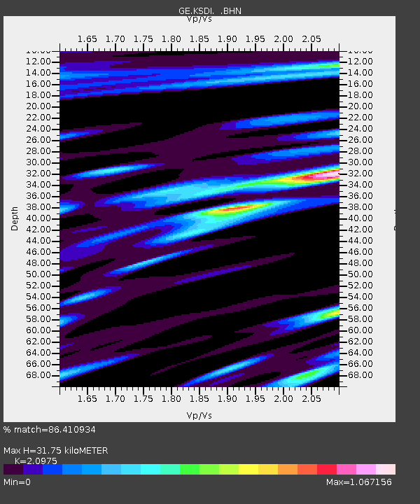
KSDI GII Station Kfar Sold, Israel - Earthquake Result Viewer

Earthquake location: Northern Sumatra, Indonesia
Earthquake latitude/longitude: 4.8/95.1
Earthquake time(UTC): 2005/10/11 (284) 15:05:39 GMT
Earthquake Depth: 30 km
Earthquake Magnitude: 6.0 MB, 5.3 MS, 5.9 MW, 5.9 MW
Earthquake Catalog/Contributor: WHDF/NEIC
Network: GE GEOFON
Station: KSDI GII Station Kfar Sold, Israel
Lat/Lon: 33.19 N/35.66 E
Elevation: 123 m
Distance: 61.9 deg
Az: 305.096 deg
Baz: 103.505 deg
Ray Param: 0.060505513
Estimated Moho Depth: 31.75 km
Estimated Crust Vp/Vs: 2.10
Assumed Crust Vp: 5.738 km/s
Estimated Crust Vs: 2.736 km/s
Estimated Crust Poisson's Ratio: 0.35
Radial Match: 86.410934 %
Radial Bump: 400
Transverse Match: 82.747 %
Transverse Bump: 400
SOD ConfigId: 2475
Insert Time: 2010-03-09 05:27:32.310 +0000
GWidth: 2.5
Max Bumps: 400
Tol: 0.001

Signal To Noise

ChannelStoNSTALTA
GE:KSDI: :BHN:20051011T15:15:25.756008Z2.30507471.794581E-77.7853485E-8
GE:KSDI: :BHE:20051011T15:15:25.756008Z5.5253013.81045E-76.896366E-8
GE:KSDI: :BHZ:20051011T15:15:25.730007Z11.3935281.0484578E-69.2022226E-8
Arrivals
Ps6.3 SECOND
PpPs17 SECOND
PsPs/PpSs23 SECOND