You are here: Home > Network List > CI - Caltech Regional Seismic Network Stations List
> Station LRL Laurel Mtn Radio Fac, Ridgecrest, CA, USA > Earthquake Result Viewer
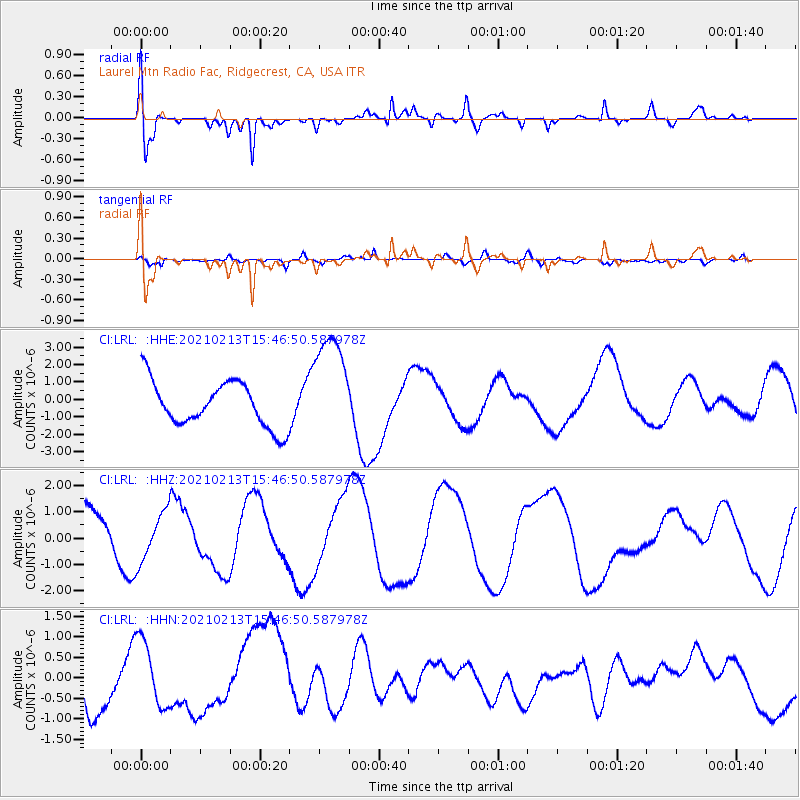
LRL Laurel Mtn Radio Fac, Ridgecrest, CA, USA - Earthquake Result Viewer
*The percent match for this event was below the threshold and hence no stack was calculated.
| Earthquake location: |
New Britain Region, P.N.G. |
| Earthquake latitude/longitude: |
-7.3/149.4 |
| Earthquake time(UTC): |
2021/02/13 (044) 15:33:57 GMT |
| Earthquake Depth: |
52 km |
| Earthquake Magnitude: |
6.0 Mww |
| Earthquake Catalog/Contributor: |
NEIC PDE/us |
|
| Network: |
CI Caltech Regional Seismic Network |
| Station: |
LRL Laurel Mtn Radio Fac, Ridgecrest, CA, USA |
| Lat/Lon: |
35.48 N/117.68 W |
| Elevation: |
1340 m |
|
| Distance: |
96.6 deg |
| Az: |
55.131 deg |
| Baz: |
265.744 deg |
| Ray Param: |
$rayparam |
*The percent match for this event was below the threshold and hence was not used in the summary stack. |
|
| Radial Match: |
66.64278 % |
| Radial Bump: |
400 |
| Transverse Match: |
39.814102 % |
| Transverse Bump: |
400 |
| SOD ConfigId: |
23341671 |
| Insert Time: |
2021-02-27 16:40:15.705 +0000 |
| GWidth: |
2.5 |
| Max Bumps: |
400 |
| Tol: |
0.001 |
|
Signal To Noise
| Channel | StoN | STA | LTA |
| CI:LRL: :HHZ:20210213T15:46:50.587978Z | 0.66888404 | 9.3906175E-7 | 1.4039231E-6 |
| CI:LRL: :HHN:20210213T15:46:50.587978Z | 1.474078 | 8.226888E-7 | 5.581039E-7 |
| CI:LRL: :HHE:20210213T15:46:50.587978Z | 2.449992 | 3.1599996E-6 | 1.2897999E-6 |
| Arrivals |
| Ps | |
| PpPs | |
| PsPs/PpSs | |


