You are here: Home > Network List > TA - USArray Transportable Network (new EarthScope stations) Stations List
> Station O17K Koliganek, Bristol Bay, AK, USA > Earthquake Result Viewer
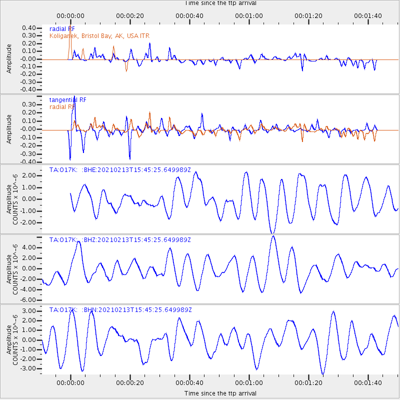
O17K Koliganek, Bristol Bay, AK, USA - Earthquake Result Viewer
*The percent match for this event was below the threshold and hence no stack was calculated.
| Earthquake location: |
New Britain Region, P.N.G. |
| Earthquake latitude/longitude: |
-7.3/149.4 |
| Earthquake time(UTC): |
2021/02/13 (044) 15:33:57 GMT |
| Earthquake Depth: |
52 km |
| Earthquake Magnitude: |
6.0 Mww |
| Earthquake Catalog/Contributor: |
NEIC PDE/us |
|
| Network: |
TA USArray Transportable Network (new EarthScope stations) |
| Station: |
O17K Koliganek, Bristol Bay, AK, USA |
| Lat/Lon: |
59.77 N/157.09 W |
| Elevation: |
156 m |
|
| Distance: |
79.1 deg |
| Az: |
24.474 deg |
| Baz: |
234.319 deg |
| Ray Param: |
$rayparam |
*The percent match for this event was below the threshold and hence was not used in the summary stack. |
|
| Radial Match: |
53.36251 % |
| Radial Bump: |
400 |
| Transverse Match: |
72.30687 % |
| Transverse Bump: |
400 |
| SOD ConfigId: |
23341671 |
| Insert Time: |
2021-02-27 16:44:34.204 +0000 |
| GWidth: |
2.5 |
| Max Bumps: |
400 |
| Tol: |
0.001 |
|
Signal To Noise
| Channel | StoN | STA | LTA |
| TA:O17K: :BHZ:20210213T15:45:25.649989Z | 1.412243 | 3.3427896E-6 | 2.3670073E-6 |
| TA:O17K: :BHN:20210213T15:45:25.649989Z | 2.2393382 | 2.3321904E-6 | 1.0414642E-6 |
| TA:O17K: :BHE:20210213T15:45:25.649989Z | 1.1824987 | 8.0740546E-7 | 6.8279604E-7 |
| Arrivals |
| Ps | |
| PpPs | |
| PsPs/PpSs | |


