You are here: Home > Network List > CI - Caltech Regional Seismic Network Stations List
> Station SWS Sam W. Stewart, Westmorland, CA, USA > Earthquake Result Viewer
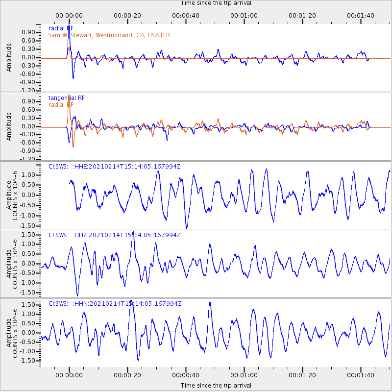
SWS Sam W. Stewart, Westmorland, CA, USA - Earthquake Result Viewer
*The percent match for this event was below the threshold and hence no stack was calculated.
| Earthquake location: |
Southeast Of Loyalty Islands |
| Earthquake latitude/longitude: |
-23.3/171.7 |
| Earthquake time(UTC): |
2021/02/14 (045) 15:01:42 GMT |
| Earthquake Depth: |
10 km |
| Earthquake Magnitude: |
5.8 mww |
| Earthquake Catalog/Contributor: |
NEIC PDE/us |
|
| Network: |
CI Caltech Regional Seismic Network |
| Station: |
SWS Sam W. Stewart, Westmorland, CA, USA |
| Lat/Lon: |
32.94 N/115.80 W |
| Elevation: |
140 m |
|
| Distance: |
88.8 deg |
| Az: |
53.324 deg |
| Baz: |
241.302 deg |
| Ray Param: |
$rayparam |
*The percent match for this event was below the threshold and hence was not used in the summary stack. |
|
| Radial Match: |
73.26364 % |
| Radial Bump: |
356 |
| Transverse Match: |
59.58069 % |
| Transverse Bump: |
395 |
| SOD ConfigId: |
23341671 |
| Insert Time: |
2021-02-28 16:08:03.953 +0000 |
| GWidth: |
2.5 |
| Max Bumps: |
400 |
| Tol: |
0.001 |
|
Signal To Noise
| Channel | StoN | STA | LTA |
| CI:SWS: :HHZ:20210214T15:14:05.167994Z | 3.3652716 | 7.560057E-7 | 2.2464926E-7 |
| CI:SWS: :HHN:20210214T15:14:05.167994Z | 0.8325931 | 5.426969E-7 | 6.518153E-7 |
| CI:SWS: :HHE:20210214T15:14:05.167994Z | 1.9228859 | 7.963952E-7 | 4.1416664E-7 |
| Arrivals |
| Ps | |
| PpPs | |
| PsPs/PpSs | |


