You are here: Home > Network List > US - United States National Seismic Network Stations List
> Station AMTX Amarillo, Texas, USA > Earthquake Result Viewer
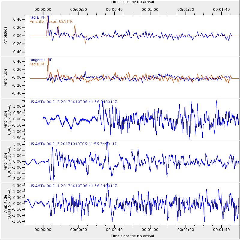
AMTX Amarillo, Texas, USA - Earthquake Result Viewer
*The percent match for this event was below the threshold and hence no stack was calculated.
| Earthquake location: |
Northern Chile |
| Earthquake latitude/longitude: |
-18.5/-69.6 |
| Earthquake time(UTC): |
2017/10/10 (283) 06:32:20 GMT |
| Earthquake Depth: |
82 km |
| Earthquake Magnitude: |
6.3 Mww |
| Earthquake Catalog/Contributor: |
NEIC PDE/us |
|
| Network: |
US United States National Seismic Network |
| Station: |
AMTX Amarillo, Texas, USA |
| Lat/Lon: |
34.53 N/101.41 W |
| Elevation: |
1010 m |
|
| Distance: |
60.8 deg |
| Az: |
330.137 deg |
| Baz: |
145.092 deg |
| Ray Param: |
$rayparam |
*The percent match for this event was below the threshold and hence was not used in the summary stack. |
|
| Radial Match: |
81.87347 % |
| Radial Bump: |
400 |
| Transverse Match: |
55.170124 % |
| Transverse Bump: |
400 |
| SOD ConfigId: |
2364251 |
| Insert Time: |
2017-10-24 06:38:07.961 +0000 |
| GWidth: |
2.5 |
| Max Bumps: |
400 |
| Tol: |
0.001 |
|
Signal To Noise
| Channel | StoN | STA | LTA |
| US:AMTX:00:BHZ:20171010T06:41:56.349011Z | 4.2120647 | 1.0768227E-6 | 2.55652E-7 |
| US:AMTX:00:BH1:20171010T06:41:56.349011Z | 1.4738429 | 3.41566E-7 | 2.3175198E-7 |
| US:AMTX:00:BH2:20171010T06:41:56.349011Z | 1.7964712 | 4.487673E-7 | 2.498049E-7 |
| Arrivals |
| Ps | |
| PpPs | |
| PsPs/PpSs | |


