
BCHU XW.BCHU - Earthquake Result Viewer
| ||||||||||||||||||
| ||||||||||||||||||
| ||||||||||||||||||
|
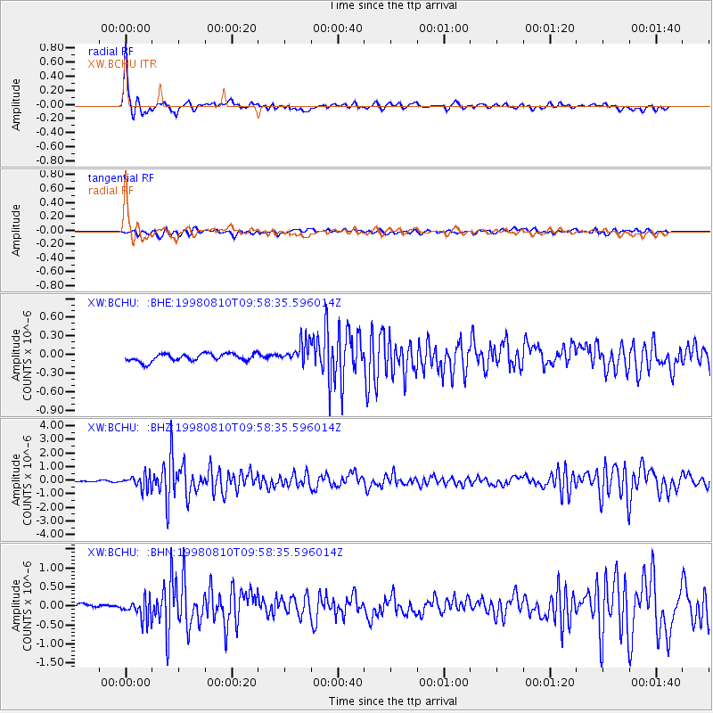
Signal To Noise
| Channel | StoN | STA | LTA |
| XW:BCHU: :BHZ:19980810T09:58:35.596014Z | 9.304963 | 4.9838644E-7 | 5.3561354E-8 |
| XW:BCHU: :BHN:19980810T09:58:35.596014Z | 5.786424 | 2.6863094E-7 | 4.6424347E-8 |
| XW:BCHU: :BHE:19980810T09:58:35.596014Z | 2.823817 | 1.7328892E-7 | 6.136691E-8 |
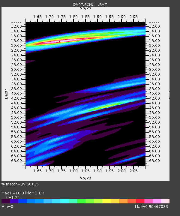
| Arrivals | |
| Ps | 2.3 SECOND |
| PpPs | 7.3 SECOND |
| PsPs/PpSs | 9.6 SECOND |

