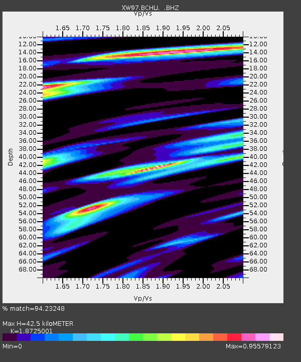
BCHU XW.BCHU - Earthquake Result Viewer
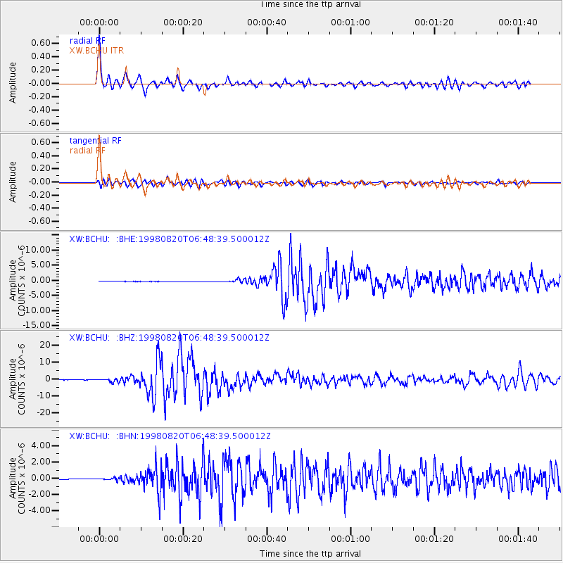
Earthquake location: Bonin Islands, Japan Region
Earthquake latitude/longitude: 28.9/139.3
Earthquake time(UTC): 1998/08/20 (232) 06:40:55 GMT
Earthquake Depth: 441 km
Earthquake Magnitude: 6.1 MB, 7.0 UNKNOWN, 7.0 MW
Earthquake Catalog/Contributor: WHDF/NEIC
Network: XW Tien Shan Continental Dynamics
Station: BCHU XW.BCHU
Lat/Lon: 39.79 N/78.78 E
Elevation: 1140 m
Distance: 50.3 deg
Az: 299.298 deg
Baz: 82.828 deg
Ray Param: 0.066292726
Estimated Moho Depth: 42.5 km
Estimated Crust Vp/Vs: 1.87
Assumed Crust Vp: 6.242 km/s
Estimated Crust Vs: 3.334 km/s
Estimated Crust Poisson's Ratio: 0.30
Radial Match: 94.23248 %
Radial Bump: 400
Transverse Match: 87.916504 %
Transverse Bump: 400
SOD ConfigId: 4480
Insert Time: 2010-02-26 15:18:40.200 +0000
GWidth: 2.5
Max Bumps: 400
Tol: 0.001

Signal To Noise

ChannelStoNSTALTA
XW:BCHU: :BHZ:19980820T06:48:39.500012Z18.5267099.6431E-75.2049717E-8
XW:BCHU: :BHN:19980820T06:48:39.500012Z3.70167881.3098305E-73.538477E-8
XW:BCHU: :BHE:19980820T06:48:39.500012Z8.490375.4351244E-76.401517E-8
Arrivals
Ps6.2 SECOND
PpPs19 SECOND
PsPs/PpSs25 SECOND