You are here: Home > Network List > US - United States National Seismic Network Stations List
> Station AMTX Amarillo, Texas, USA > Earthquake Result Viewer
AMTX Amarillo, Texas, USA - Earthquake Result Viewer
*The percent match for this event was below the threshold and hence no stack was calculated.
| Earthquake location: |
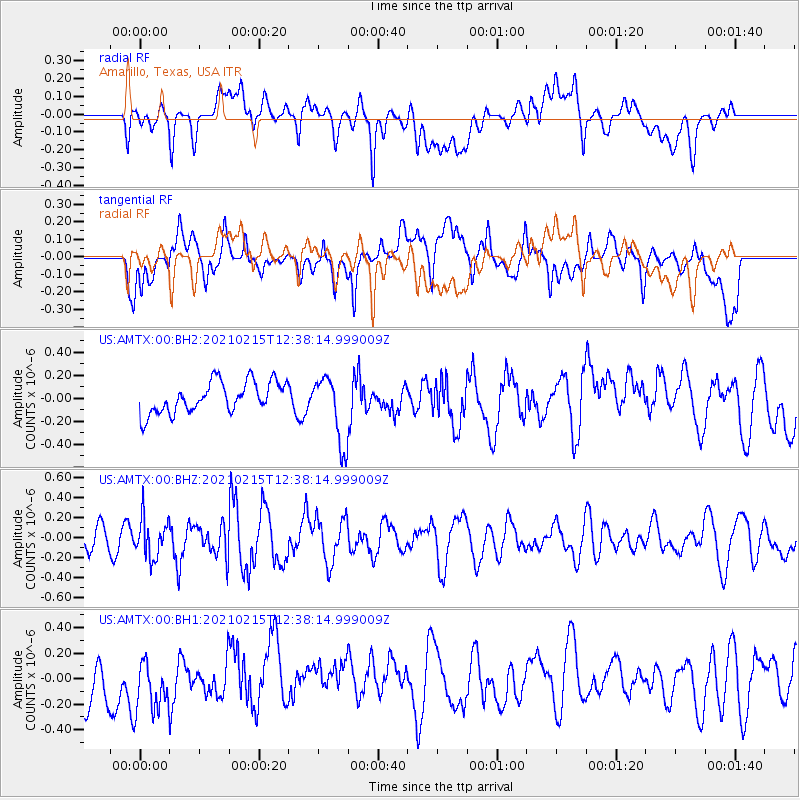
Near East Coast Of Honshu, Japan |
| Earthquake latitude/longitude: |
37.5/141.6 |
| Earthquake time(UTC): |
2021/02/15 (046) 12:26:04 GMT |
| Earthquake Depth: |
36 km |
| Earthquake Magnitude: |
5.3 Mww |
| Earthquake Catalog/Contributor: |
NEIC PDE/us |
|
| Network: |
US United States National Seismic Network |
| Station: |
AMTX Amarillo, Texas, USA |
| Lat/Lon: |
34.53 N/101.41 W |
| Elevation: |
1010 m |
|
| Distance: |
87.5 deg |
| Az: |
47.413 deg |
| Baz: |
314.84 deg |
| Ray Param: |
$rayparam |
*The percent match for this event was below the threshold and hence was not used in the summary stack. |
|
| Radial Match: |
45.5404 % |
| Radial Bump: |
400 |
| Transverse Match: |
47.524796 % |
| Transverse Bump: |
400 |
| SOD ConfigId: |
23341671 |
| Insert Time: |
2021-03-01 13:46:53.932 +0000 |
| GWidth: |
2.5 |
| Max Bumps: |
400 |
| Tol: |
0.001 |
|
Signal To Noise
| Channel | StoN | STA | LTA |
| US:AMTX:00:BHZ:20210215T12:38:14.999009Z | 1.1194419 | 1.9365505E-7 | 1.729925E-7 |
| US:AMTX:00:BH1:20210215T12:38:14.999009Z | 1.2245979 | 2.417903E-7 | 1.9744465E-7 |
| US:AMTX:00:BH2:20210215T12:38:14.999009Z | 2.6172788 | 3.2399169E-7 | 1.2378952E-7 |
| Arrivals |
| Ps | |
| PpPs | |
| PsPs/PpSs | |


