You are here: Home > Network List > TA - USArray Transportable Network (new EarthScope stations) Stations List
> Station G21K Allakaket, AK, USA > Earthquake Result Viewer
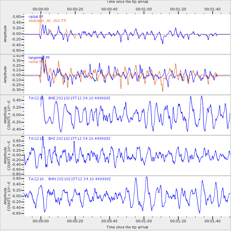
G21K Allakaket, AK, USA - Earthquake Result Viewer
*The percent match for this event was below the threshold and hence no stack was calculated.
| Earthquake location: |
Near East Coast Of Honshu, Japan |
| Earthquake latitude/longitude: |
37.5/141.4 |
| Earthquake time(UTC): |
2021/02/15 (046) 12:26:18 GMT |
| Earthquake Depth: |
40 km |
| Earthquake Magnitude: |
5.3 Mww |
| Earthquake Catalog/Contributor: |
NEIC PDE/us |
|
| Network: |
TA USArray Transportable Network (new EarthScope stations) |
| Station: |
G21K Allakaket, AK, USA |
| Lat/Lon: |
66.52 N/153.51 W |
| Elevation: |
446 m |
|
| Distance: |
46.4 deg |
| Az: |
30.145 deg |
| Baz: |
264.97 deg |
| Ray Param: |
$rayparam |
*The percent match for this event was below the threshold and hence was not used in the summary stack. |
|
| Radial Match: |
58.631855 % |
| Radial Bump: |
400 |
| Transverse Match: |
81.89233 % |
| Transverse Bump: |
400 |
| SOD ConfigId: |
23341671 |
| Insert Time: |
2021-03-01 14:05:15.739 +0000 |
| GWidth: |
2.5 |
| Max Bumps: |
400 |
| Tol: |
0.001 |
|
Signal To Noise
| Channel | StoN | STA | LTA |
| TA:G21K: :BHZ:20210215T12:34:10.449999Z | 1.6750301 | 3.4726898E-7 | 2.0732102E-7 |
| TA:G21K: :BHN:20210215T12:34:10.449999Z | 1.813406 | 3.1854645E-7 | 1.7566197E-7 |
| TA:G21K: :BHE:20210215T12:34:10.449999Z | 0.61232585 | 1.4370889E-7 | 2.3469349E-7 |
| Arrivals |
| Ps | |
| PpPs | |
| PsPs/PpSs | |


