You are here: Home > Network List > UU - University of Utah Regional Network Stations List
> Station KNB Kanab, UT, USA > Earthquake Result Viewer
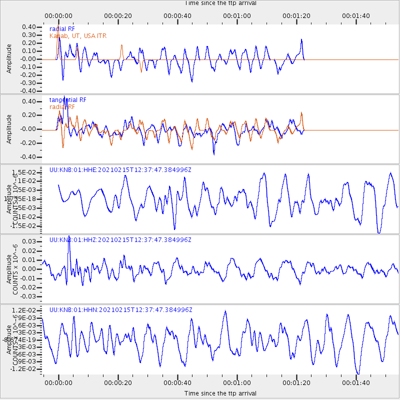
KNB Kanab, UT, USA - Earthquake Result Viewer
*The percent match for this event was below the threshold and hence no stack was calculated.
| Earthquake location: |
Near East Coast Of Honshu, Japan |
| Earthquake latitude/longitude: |
37.5/141.4 |
| Earthquake time(UTC): |
2021/02/15 (046) 12:26:18 GMT |
| Earthquake Depth: |
40 km |
| Earthquake Magnitude: |
5.3 Mww |
| Earthquake Catalog/Contributor: |
NEIC PDE/us |
|
| Network: |
UU University of Utah Regional Network |
| Station: |
KNB Kanab, UT, USA |
| Lat/Lon: |
37.02 N/112.82 W |
| Elevation: |
1715 m |
|
| Distance: |
79.0 deg |
| Az: |
51.682 deg |
| Baz: |
308.809 deg |
| Ray Param: |
$rayparam |
*The percent match for this event was below the threshold and hence was not used in the summary stack. |
|
| Radial Match: |
36.477673 % |
| Radial Bump: |
400 |
| Transverse Match: |
63.235435 % |
| Transverse Bump: |
400 |
| SOD ConfigId: |
23341671 |
| Insert Time: |
2021-03-01 14:07:26.999 +0000 |
| GWidth: |
2.5 |
| Max Bumps: |
400 |
| Tol: |
0.001 |
|
Signal To Noise
| Channel | StoN | STA | LTA |
| UU:KNB:01:HHZ:20210215T12:37:47.384996Z | 1.7464802 | 1.252444E-8 | 7.1712463E-9 |
| UU:KNB:01:HHN:20210215T12:37:47.384996Z | 0.92570543 | 5.2622666E-9 | 5.6846017E-9 |
| UU:KNB:01:HHE:20210215T12:37:47.384996Z | 0.8372679 | 4.149561E-9 | 4.9560733E-9 |
| Arrivals |
| Ps | |
| PpPs | |
| PsPs/PpSs | |


