BCHU XW.BCHU - Earthquake Result Viewer
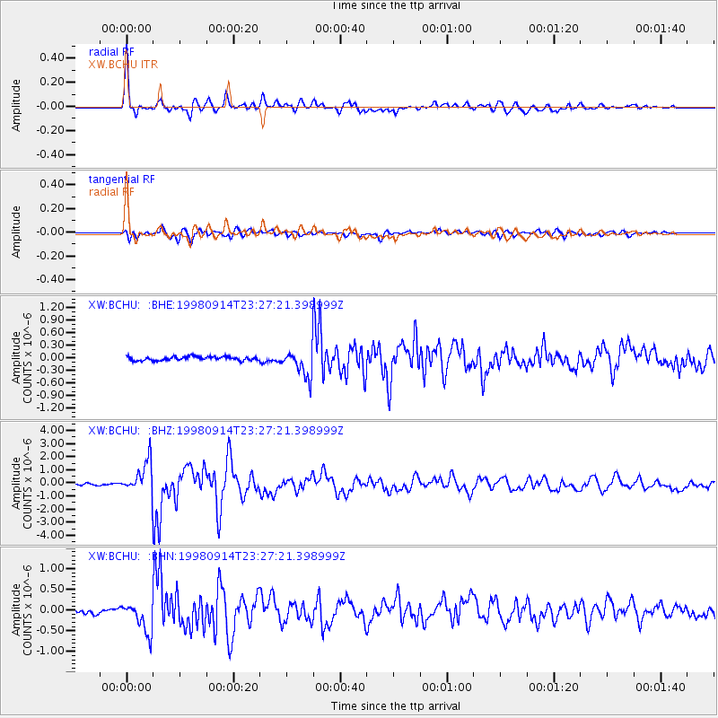
Earthquake location: Andreanof Islands, Aleutian Is.
Earthquake latitude/longitude: 51.6/-173.1
Earthquake time(UTC): 1998/09/14 (257) 23:16:46 GMT
Earthquake Depth: 33 km
Earthquake Magnitude: 5.7 MB, 6.0 MS, 6.2 UNKNOWN, 5.7 ML
Earthquake Catalog/Contributor: WHDF/NEIC
Network: XW Tien Shan Continental Dynamics
Station: BCHU XW.BCHU
Lat/Lon: 39.79 N/78.78 E
Elevation: 1140 m
Distance: 69.5 deg
Az: 308.578 deg
Baz: 39.242 deg
Ray Param: 0.055524312
Estimated Moho Depth: 63.25 km
Estimated Crust Vp/Vs: 1.60
Assumed Crust Vp: 6.242 km/s
Estimated Crust Vs: 3.901 km/s
Estimated Crust Poisson's Ratio: 0.18
Radial Match: 93.06644 %
Radial Bump: 400
Transverse Match: 83.69511 %
Transverse Bump: 400
SOD ConfigId: 4480
Insert Time: 2010-02-26 15:18:50.257 +0000
GWidth: 2.5
Max Bumps: 400
Tol: 0.001

Signal To Noise

ChannelStoNSTALTA
XW:BCHU: :BHZ:19980914T23:27:21.398999Z16.4728181.2259086E-67.4420086E-8
XW:BCHU: :BHN:19980914T23:27:21.398999Z7.45767453.6762717E-74.9295146E-8
XW:BCHU: :BHE:19980914T23:27:21.398999Z7.10939843.2307872E-74.5443894E-8
Arrivals
Ps6.3 SECOND
PpPs25 SECOND
PsPs/PpSs32 SECOND