
BCHU XW.BCHU - Earthquake Result Viewer
| ||||||||||||||||||
| ||||||||||||||||||
| ||||||||||||||||||
|
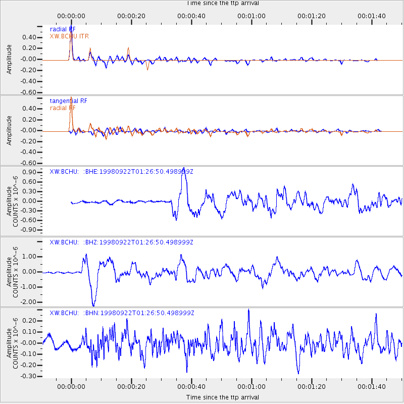
Signal To Noise
| Channel | StoN | STA | LTA |
| XW:BCHU: :BHZ:19980922T01:26:50.498999Z | 8.61679 | 3.8952754E-7 | 4.5205642E-8 |
| XW:BCHU: :BHN:19980922T01:26:50.498999Z | 1.4138407 | 5.1439635E-8 | 3.6382907E-8 |
| XW:BCHU: :BHE:19980922T01:26:50.498999Z | 5.5650015 | 1.7622901E-7 | 3.166738E-8 |
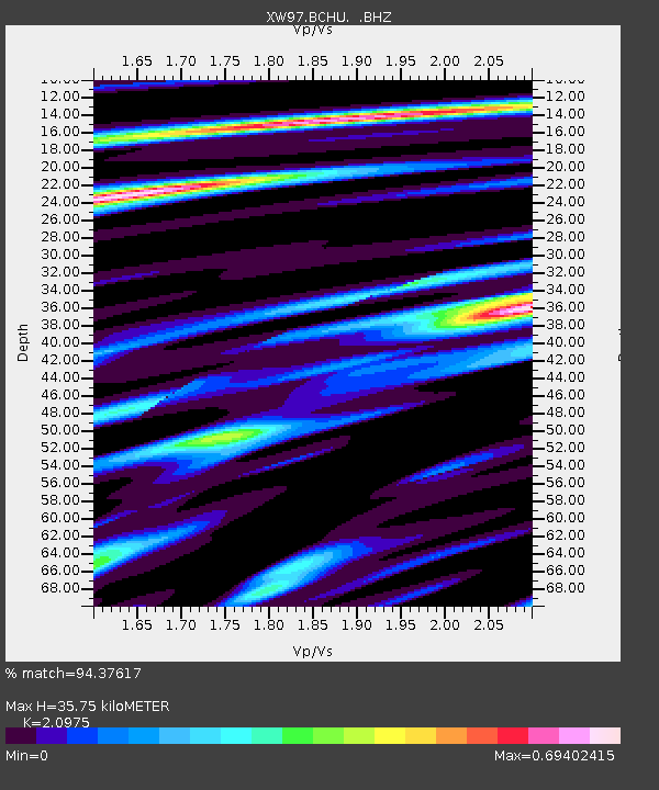
| Arrivals | |
| Ps | 6.5 SECOND |
| PpPs | 17 SECOND |
| PsPs/PpSs | 24 SECOND |

