You are here: Home > Network List > US - United States National Seismic Network Stations List
> Station EGMT Eagleton, Montana, USA > Earthquake Result Viewer
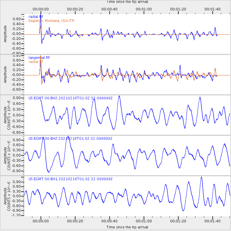
EGMT Eagleton, Montana, USA - Earthquake Result Viewer
*The percent match for this event was below the threshold and hence no stack was calculated.
| Earthquake location: |
Vanuatu Islands |
| Earthquake latitude/longitude: |
-17.8/167.5 |
| Earthquake time(UTC): |
2021/02/16 (047) 00:49:26 GMT |
| Earthquake Depth: |
10 km |
| Earthquake Magnitude: |
6.2 Mww |
| Earthquake Catalog/Contributor: |
NEIC PDE/us |
|
| Network: |
US United States National Seismic Network |
| Station: |
EGMT Eagleton, Montana, USA |
| Lat/Lon: |
48.02 N/109.75 W |
| Elevation: |
1055 m |
|
| Distance: |
98.3 deg |
| Az: |
42.305 deg |
| Baz: |
252.784 deg |
| Ray Param: |
$rayparam |
*The percent match for this event was below the threshold and hence was not used in the summary stack. |
|
| Radial Match: |
47.762756 % |
| Radial Bump: |
400 |
| Transverse Match: |
53.247673 % |
| Transverse Bump: |
400 |
| SOD ConfigId: |
23341671 |
| Insert Time: |
2021-03-02 02:09:51.782 +0000 |
| GWidth: |
2.5 |
| Max Bumps: |
400 |
| Tol: |
0.001 |
|
Signal To Noise
| Channel | StoN | STA | LTA |
| US:EGMT:00:BHZ:20210216T01:02:32.099999Z | 2.8017435 | 6.871271E-7 | 2.4524982E-7 |
| US:EGMT:00:BH1:20210216T01:02:32.099999Z | 1.1667767 | 2.3935922E-7 | 2.051457E-7 |
| US:EGMT:00:BH2:20210216T01:02:32.099999Z | 1.589585 | 4.965555E-7 | 3.1238062E-7 |
| Arrivals |
| Ps | |
| PpPs | |
| PsPs/PpSs | |


