You are here: Home > Network List > US - United States National Seismic Network Stations List
> Station WUAZ Wupatki, Arizona, USA > Earthquake Result Viewer
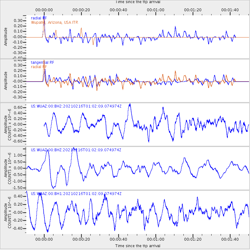
WUAZ Wupatki, Arizona, USA - Earthquake Result Viewer
*The percent match for this event was below the threshold and hence no stack was calculated.
| Earthquake location: |
Vanuatu Islands |
| Earthquake latitude/longitude: |
-17.8/167.5 |
| Earthquake time(UTC): |
2021/02/16 (047) 00:49:26 GMT |
| Earthquake Depth: |
10 km |
| Earthquake Magnitude: |
6.2 Mww |
| Earthquake Catalog/Contributor: |
NEIC PDE/us |
|
| Network: |
US United States National Seismic Network |
| Station: |
WUAZ Wupatki, Arizona, USA |
| Lat/Lon: |
35.52 N/111.37 W |
| Elevation: |
1592 m |
|
| Distance: |
93.2 deg |
| Az: |
53.84 deg |
| Baz: |
250.536 deg |
| Ray Param: |
$rayparam |
*The percent match for this event was below the threshold and hence was not used in the summary stack. |
|
| Radial Match: |
67.73703 % |
| Radial Bump: |
400 |
| Transverse Match: |
43.498528 % |
| Transverse Bump: |
400 |
| SOD ConfigId: |
23341671 |
| Insert Time: |
2021-03-02 02:10:10.658 +0000 |
| GWidth: |
2.5 |
| Max Bumps: |
400 |
| Tol: |
0.001 |
|
Signal To Noise
| Channel | StoN | STA | LTA |
| US:WUAZ:00:BHZ:20210216T01:02:09.074974Z | 9.709215 | 1.0E-6 | 1.0299493E-7 |
| US:WUAZ:00:BH1:20210216T01:02:09.074974Z | 1.1245193 | 2.7886065E-7 | 2.479821E-7 |
| US:WUAZ:00:BH2:20210216T01:02:09.074974Z | 1.2950932 | 2.902645E-7 | 2.2412634E-7 |
| Arrivals |
| Ps | |
| PpPs | |
| PsPs/PpSs | |


