You are here: Home > Network List > WY - Yellowstone Wyoming Seismic Network Stations List
> Station YHH Holmes Hill, YNP, WY, USA > Earthquake Result Viewer
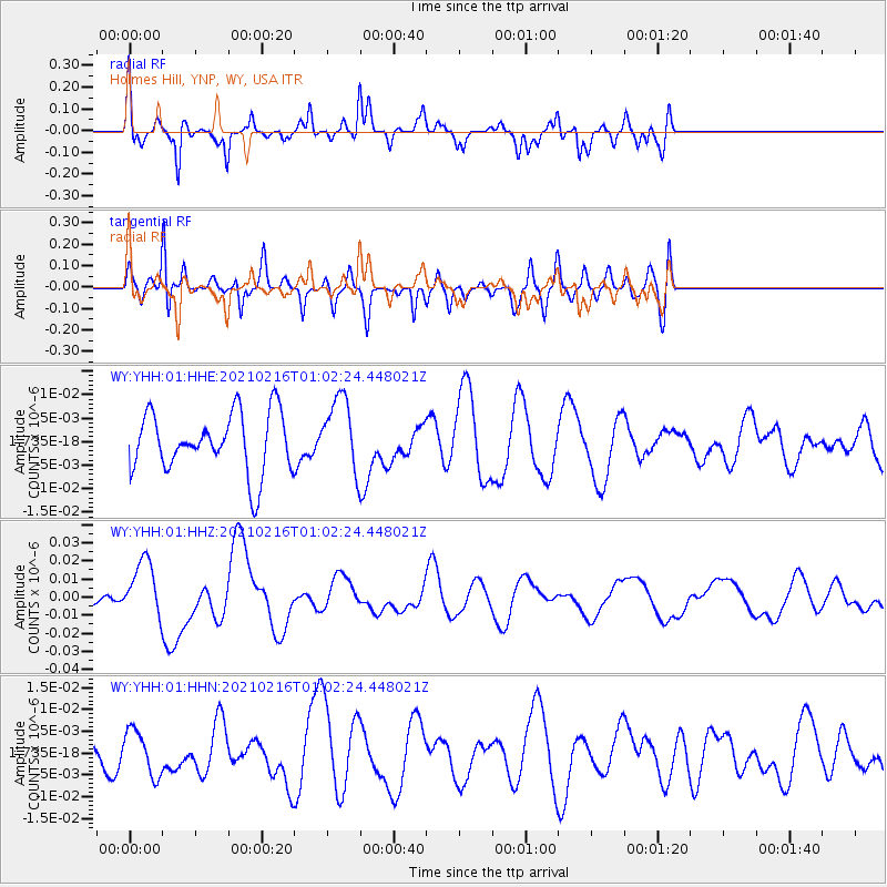
YHH Holmes Hill, YNP, WY, USA - Earthquake Result Viewer
*The percent match for this event was below the threshold and hence no stack was calculated.
| Earthquake location: |
Vanuatu Islands |
| Earthquake latitude/longitude: |
-17.8/167.5 |
| Earthquake time(UTC): |
2021/02/16 (047) 00:49:26 GMT |
| Earthquake Depth: |
10 km |
| Earthquake Magnitude: |
6.2 Mww |
| Earthquake Catalog/Contributor: |
NEIC PDE/us |
|
| Network: |
WY Yellowstone Wyoming Seismic Network |
| Station: |
YHH Holmes Hill, YNP, WY, USA |
| Lat/Lon: |
44.79 N/110.85 W |
| Elevation: |
2717 m |
|
| Distance: |
96.6 deg |
| Az: |
45.179 deg |
| Baz: |
251.619 deg |
| Ray Param: |
$rayparam |
*The percent match for this event was below the threshold and hence was not used in the summary stack. |
|
| Radial Match: |
59.005585 % |
| Radial Bump: |
323 |
| Transverse Match: |
70.4718 % |
| Transverse Bump: |
400 |
| SOD ConfigId: |
23341671 |
| Insert Time: |
2021-03-02 02:12:40.902 +0000 |
| GWidth: |
2.5 |
| Max Bumps: |
400 |
| Tol: |
0.001 |
|
Signal To Noise
| Channel | StoN | STA | LTA |
| WY:YHH:01:HHZ:20210216T01:02:24.448021Z | 2.5568967 | 1.5565016E-8 | 6.087464E-9 |
| WY:YHH:01:HHN:20210216T01:02:24.448021Z | 1.2729245 | 5.1466214E-9 | 4.0431476E-9 |
| WY:YHH:01:HHE:20210216T01:02:24.448021Z | 1.2500745 | 7.845518E-9 | 6.2760406E-9 |
| Arrivals |
| Ps | |
| PpPs | |
| PsPs/PpSs | |


