You are here: Home > Network List > CI - Caltech Regional Seismic Network Stations List
> Station DAN Danby, California, USA > Earthquake Result Viewer
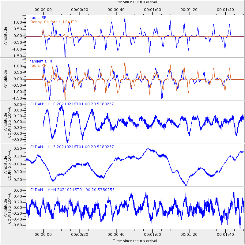
DAN Danby, California, USA - Earthquake Result Viewer
*The percent match for this event was below the threshold and hence no stack was calculated.
| Earthquake location: |
Tonga Islands Region |
| Earthquake latitude/longitude: |
-17.8/-167.8 |
| Earthquake time(UTC): |
2021/02/16 (047) 00:49:28 GMT |
| Earthquake Depth: |
14 km |
| Earthquake Magnitude: |
6.7 Mi |
| Earthquake Catalog/Contributor: |
NEIC PDE/at |
|
| Network: |
CI Caltech Regional Seismic Network |
| Station: |
DAN Danby, California, USA |
| Lat/Lon: |
34.64 N/115.38 W |
| Elevation: |
398 m |
|
| Distance: |
72.1 deg |
| Az: |
43.366 deg |
| Baz: |
232.504 deg |
| Ray Param: |
$rayparam |
*The percent match for this event was below the threshold and hence was not used in the summary stack. |
|
| Radial Match: |
36.32993 % |
| Radial Bump: |
400 |
| Transverse Match: |
46.765415 % |
| Transverse Bump: |
400 |
| SOD ConfigId: |
23341671 |
| Insert Time: |
2021-03-02 02:18:43.701 +0000 |
| GWidth: |
2.5 |
| Max Bumps: |
400 |
| Tol: |
0.001 |
|
Signal To Noise
| Channel | StoN | STA | LTA |
| CI:DAN: :HHZ:20210216T01:00:20.538025Z | 2.0294318 | 1.3908024E-7 | 6.853162E-8 |
| CI:DAN: :HHN:20210216T01:00:20.538025Z | 0.6899103 | 1.7426827E-7 | 2.5259556E-7 |
| CI:DAN: :HHE:20210216T01:00:20.538025Z | 0.5096087 | 2.634715E-7 | 5.1700744E-7 |
| Arrivals |
| Ps | |
| PpPs | |
| PsPs/PpSs | |


