You are here: Home > Network List > CI - Caltech Regional Seismic Network Stations List
> Station LRL Laurel Mtn Radio Fac, Ridgecrest, CA, USA > Earthquake Result Viewer
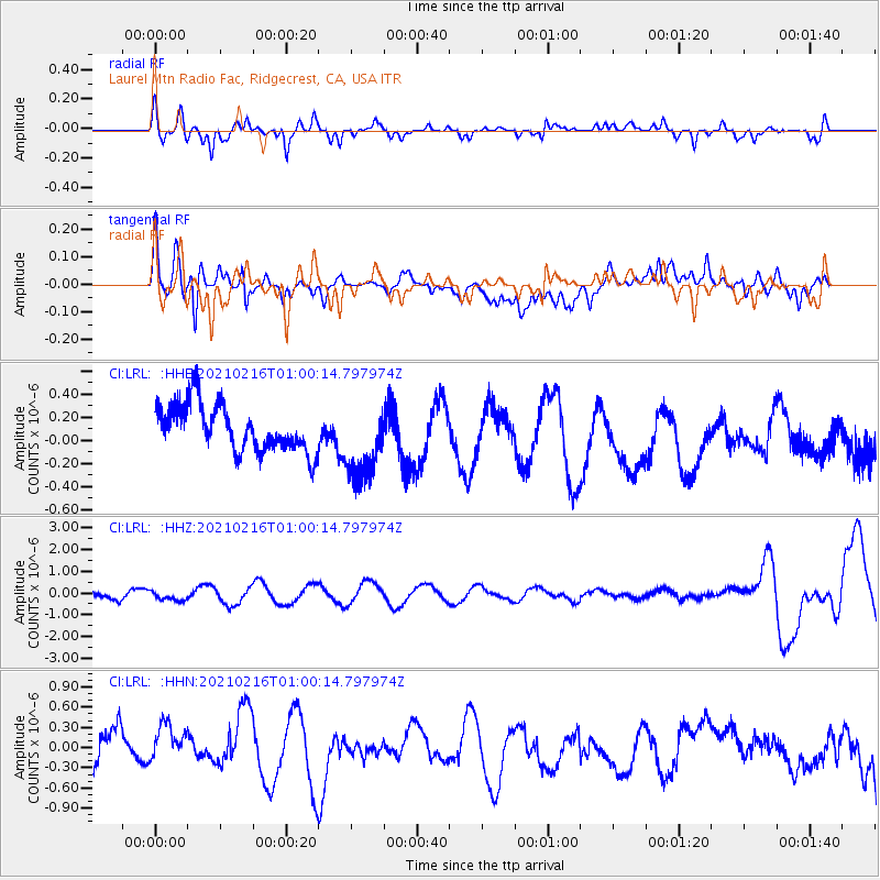
LRL Laurel Mtn Radio Fac, Ridgecrest, CA, USA - Earthquake Result Viewer
*The percent match for this event was below the threshold and hence no stack was calculated.
| Earthquake location: |
Tonga Islands Region |
| Earthquake latitude/longitude: |
-17.8/-167.8 |
| Earthquake time(UTC): |
2021/02/16 (047) 00:49:28 GMT |
| Earthquake Depth: |
14 km |
| Earthquake Magnitude: |
6.7 Mi |
| Earthquake Catalog/Contributor: |
NEIC PDE/at |
|
| Network: |
CI Caltech Regional Seismic Network |
| Station: |
LRL Laurel Mtn Radio Fac, Ridgecrest, CA, USA |
| Lat/Lon: |
35.48 N/117.68 W |
| Elevation: |
1340 m |
|
| Distance: |
71.2 deg |
| Az: |
41.435 deg |
| Baz: |
230.579 deg |
| Ray Param: |
$rayparam |
*The percent match for this event was below the threshold and hence was not used in the summary stack. |
|
| Radial Match: |
60.326546 % |
| Radial Bump: |
344 |
| Transverse Match: |
59.6561 % |
| Transverse Bump: |
400 |
| SOD ConfigId: |
23341671 |
| Insert Time: |
2021-03-02 02:19:06.667 +0000 |
| GWidth: |
2.5 |
| Max Bumps: |
400 |
| Tol: |
0.001 |
|
Signal To Noise
| Channel | StoN | STA | LTA |
| CI:LRL: :HHZ:20210216T01:00:14.797974Z | 1.3113679 | 2.1635961E-7 | 1.6498774E-7 |
| CI:LRL: :HHN:20210216T01:00:14.797974Z | 1.1500509 | 3.463347E-7 | 3.011473E-7 |
| CI:LRL: :HHE:20210216T01:00:14.797974Z | 1.6716498 | 3.3934387E-7 | 2.0299937E-7 |
| Arrivals |
| Ps | |
| PpPs | |
| PsPs/PpSs | |


