You are here: Home > Network List > TA - USArray Transportable Network (new EarthScope stations) Stations List
> Station O17K Koliganek, Bristol Bay, AK, USA > Earthquake Result Viewer
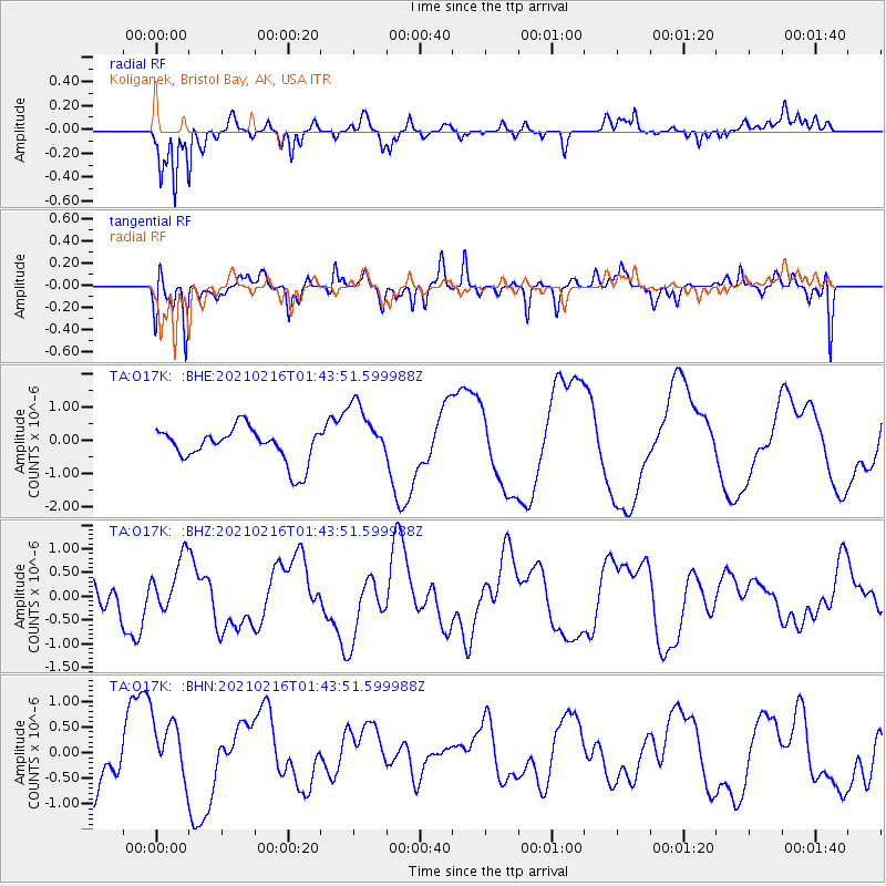
O17K Koliganek, Bristol Bay, AK, USA - Earthquake Result Viewer
*The percent match for this event was below the threshold and hence no stack was calculated.
| Earthquake location: |
Vanuatu Islands |
| Earthquake latitude/longitude: |
-17.8/167.6 |
| Earthquake time(UTC): |
2021/02/16 (047) 01:32:00 GMT |
| Earthquake Depth: |
10 km |
| Earthquake Magnitude: |
5.7 Mww |
| Earthquake Catalog/Contributor: |
NEIC PDE/us |
|
| Network: |
TA USArray Transportable Network (new EarthScope stations) |
| Station: |
O17K Koliganek, Bristol Bay, AK, USA |
| Lat/Lon: |
59.77 N/157.09 W |
| Elevation: |
156 m |
|
| Distance: |
82.5 deg |
| Az: |
17.139 deg |
| Baz: |
213.696 deg |
| Ray Param: |
$rayparam |
*The percent match for this event was below the threshold and hence was not used in the summary stack. |
|
| Radial Match: |
86.73818 % |
| Radial Bump: |
294 |
| Transverse Match: |
91.22131 % |
| Transverse Bump: |
343 |
| SOD ConfigId: |
23341671 |
| Insert Time: |
2021-03-02 02:51:41.626 +0000 |
| GWidth: |
2.5 |
| Max Bumps: |
400 |
| Tol: |
0.001 |
|
Signal To Noise
| Channel | StoN | STA | LTA |
| TA:O17K: :BHZ:20210216T01:43:51.599988Z | 1.0195314 | 5.5298267E-7 | 5.423891E-7 |
| TA:O17K: :BHN:20210216T01:43:51.599988Z | 0.98180634 | 6.3139083E-7 | 6.43091E-7 |
| TA:O17K: :BHE:20210216T01:43:51.599988Z | 1.8044947 | 9.304273E-7 | 5.156165E-7 |
| Arrivals |
| Ps | |
| PpPs | |
| PsPs/PpSs | |


