BCHU XW.BCHU - Earthquake Result Viewer
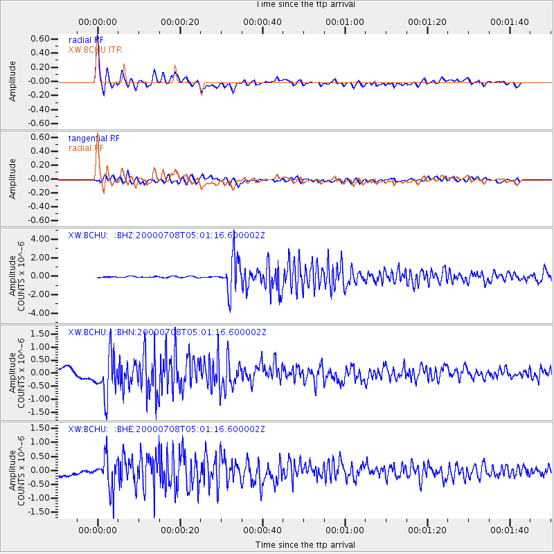
Earthquake location: Southern Sumatra, Indonesia
Earthquake latitude/longitude: -5.4/102.7
Earthquake time(UTC): 2000/07/08 (190) 04:52:55 GMT
Earthquake Depth: 33 km
Earthquake Magnitude: 5.7 MB, 5.7 MS, 5.9 MW, 5.8 MW
Earthquake Catalog/Contributor: WHDF/NEIC
Network: XW Tien Shan Continental Dynamics
Station: BCHU XW.BCHU
Lat/Lon: 39.79 N/78.78 E
Elevation: 1140 m
Distance: 50.1 deg
Az: 335.971 deg
Baz: 148.251 deg
Ray Param: 0.068221286
Estimated Moho Depth: 45.75 km
Estimated Crust Vp/Vs: 1.78
Assumed Crust Vp: 6.242 km/s
Estimated Crust Vs: 3.502 km/s
Estimated Crust Poisson's Ratio: 0.27
Radial Match: 86.86476 %
Radial Bump: 400
Transverse Match: 76.136734 %
Transverse Bump: 400
SOD ConfigId: 20082
Insert Time: 2010-02-26 15:19:14.144 +0000
GWidth: 2.5
Max Bumps: 400
Tol: 0.001

Signal To Noise

ChannelStoNSTALTA
XW:BCHU: :BHN:20000708T05:01:16.600002Z7.8495958.501179E-71.0830085E-7
XW:BCHU: :BHE:20000708T05:01:16.600002Z3.62585145.807547E-71.6017059E-7
XW:BCHU: :BHZ:20000708T05:01:16.600002Z30.891261.9257814E-66.234065E-8
Arrivals
Ps6.1 SECOND
PpPs19 SECOND
PsPs/PpSs25 SECOND