You are here: Home > Network List > CI - Caltech Regional Seismic Network Stations List
> Station DAN Danby, California, USA > Earthquake Result Viewer
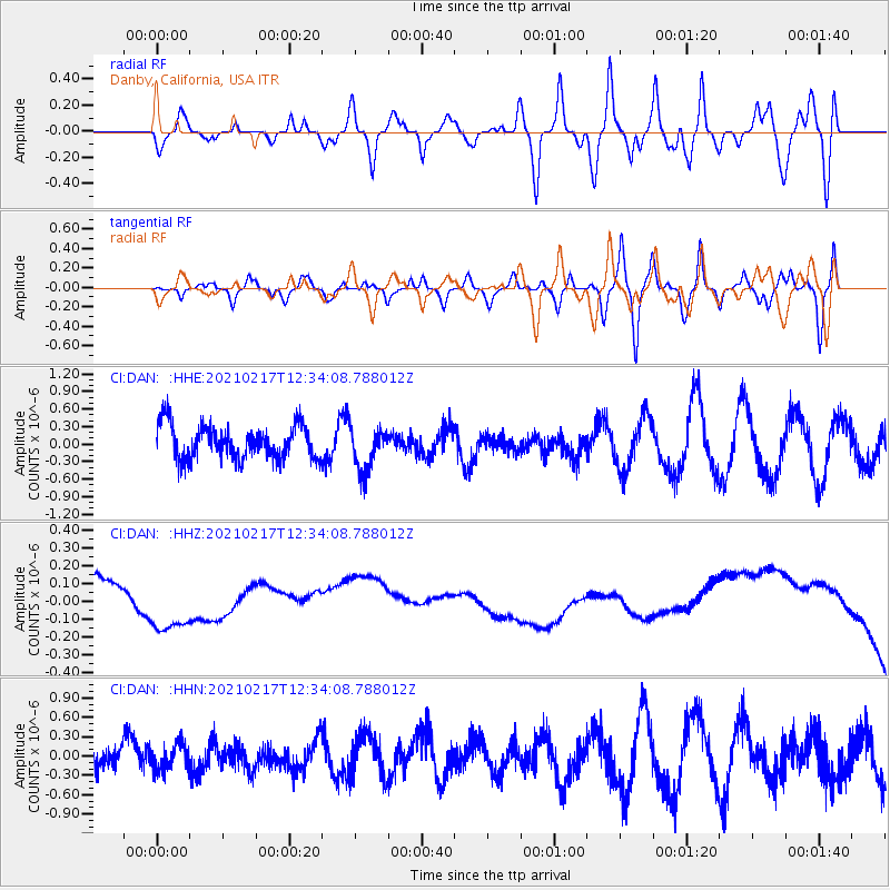
DAN Danby, California, USA - Earthquake Result Viewer
*The percent match for this event was below the threshold and hence no stack was calculated.
| Earthquake location: |
Vanuatu Islands |
| Earthquake latitude/longitude: |
-17.5/167.6 |
| Earthquake time(UTC): |
2021/02/17 (048) 12:21:42 GMT |
| Earthquake Depth: |
10 km |
| Earthquake Magnitude: |
5.5 Mww |
| Earthquake Catalog/Contributor: |
NEIC PDE/us |
|
| Network: |
CI Caltech Regional Seismic Network |
| Station: |
DAN Danby, California, USA |
| Lat/Lon: |
34.64 N/115.38 W |
| Elevation: |
398 m |
|
| Distance: |
89.5 deg |
| Az: |
53.457 deg |
| Baz: |
248.43 deg |
| Ray Param: |
$rayparam |
*The percent match for this event was below the threshold and hence was not used in the summary stack. |
|
| Radial Match: |
22.879313 % |
| Radial Bump: |
400 |
| Transverse Match: |
25.06706 % |
| Transverse Bump: |
400 |
| SOD ConfigId: |
23341671 |
| Insert Time: |
2021-03-03 13:28:26.152 +0000 |
| GWidth: |
2.5 |
| Max Bumps: |
400 |
| Tol: |
0.001 |
|
Signal To Noise
| Channel | StoN | STA | LTA |
| CI:DAN: :HHZ:20210217T12:34:08.788012Z | 0.18352067 | 3.8900907E-8 | 2.1197016E-7 |
| CI:DAN: :HHN:20210217T12:34:08.788012Z | 0.6516932 | 2.006344E-7 | 3.0786634E-7 |
| CI:DAN: :HHE:20210217T12:34:08.788012Z | 1.2890481 | 3.7272477E-7 | 2.891473E-7 |
| Arrivals |
| Ps | |
| PpPs | |
| PsPs/PpSs | |


