You are here: Home > Network List > IW - Intermountain West Stations List
> Station PLID Pearl Lake, Idaho, USA > Earthquake Result Viewer
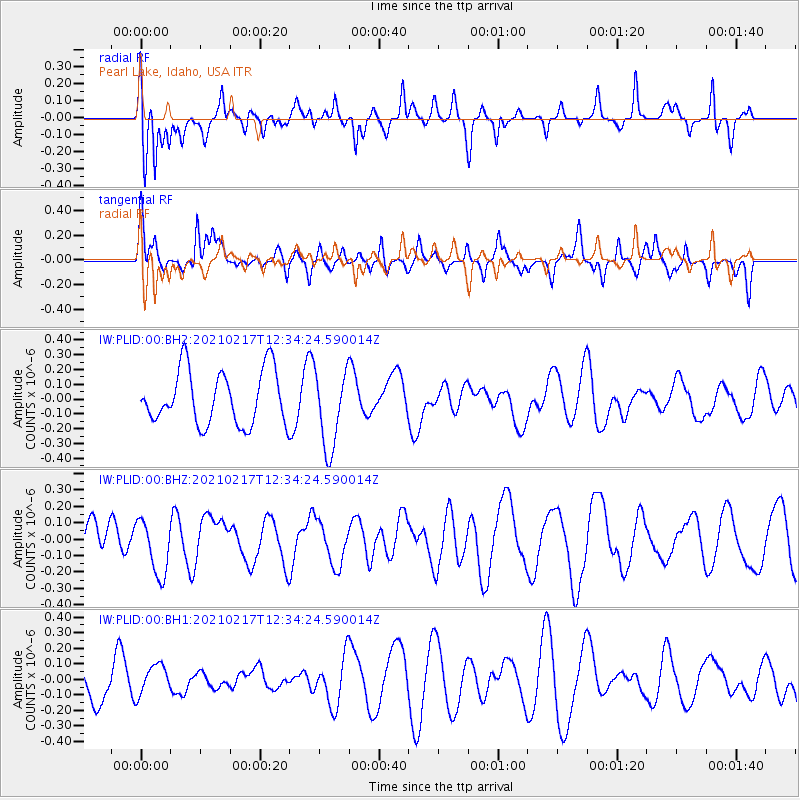
PLID Pearl Lake, Idaho, USA - Earthquake Result Viewer
*The percent match for this event was below the threshold and hence no stack was calculated.
| Earthquake location: |
Vanuatu Islands |
| Earthquake latitude/longitude: |
-17.5/167.6 |
| Earthquake time(UTC): |
2021/02/17 (048) 12:21:42 GMT |
| Earthquake Depth: |
10 km |
| Earthquake Magnitude: |
5.5 Mww |
| Earthquake Catalog/Contributor: |
NEIC PDE/us |
|
| Network: |
IW Intermountain West |
| Station: |
PLID Pearl Lake, Idaho, USA |
| Lat/Lon: |
45.09 N/116.00 W |
| Elevation: |
2164 m |
|
| Distance: |
92.9 deg |
| Az: |
43.58 deg |
| Baz: |
248.246 deg |
| Ray Param: |
$rayparam |
*The percent match for this event was below the threshold and hence was not used in the summary stack. |
|
| Radial Match: |
56.561848 % |
| Radial Bump: |
400 |
| Transverse Match: |
46.85827 % |
| Transverse Bump: |
392 |
| SOD ConfigId: |
23341671 |
| Insert Time: |
2021-03-03 13:31:08.114 +0000 |
| GWidth: |
2.5 |
| Max Bumps: |
400 |
| Tol: |
0.001 |
|
Signal To Noise
| Channel | StoN | STA | LTA |
| IW:PLID:00:BHZ:20210217T12:34:24.590014Z | 1.291123 | 1.7041373E-7 | 1.3198876E-7 |
| IW:PLID:00:BH1:20210217T12:34:24.590014Z | 0.8116586 | 9.8860376E-8 | 1.2180044E-7 |
| IW:PLID:00:BH2:20210217T12:34:24.590014Z | 1.4645845 | 2.6667178E-7 | 1.8208014E-7 |
| Arrivals |
| Ps | |
| PpPs | |
| PsPs/PpSs | |


