You are here: Home > Network List > TA - USArray Transportable Network (new EarthScope stations) Stations List
> Station F14K Arctic Creek, AK, USA > Earthquake Result Viewer
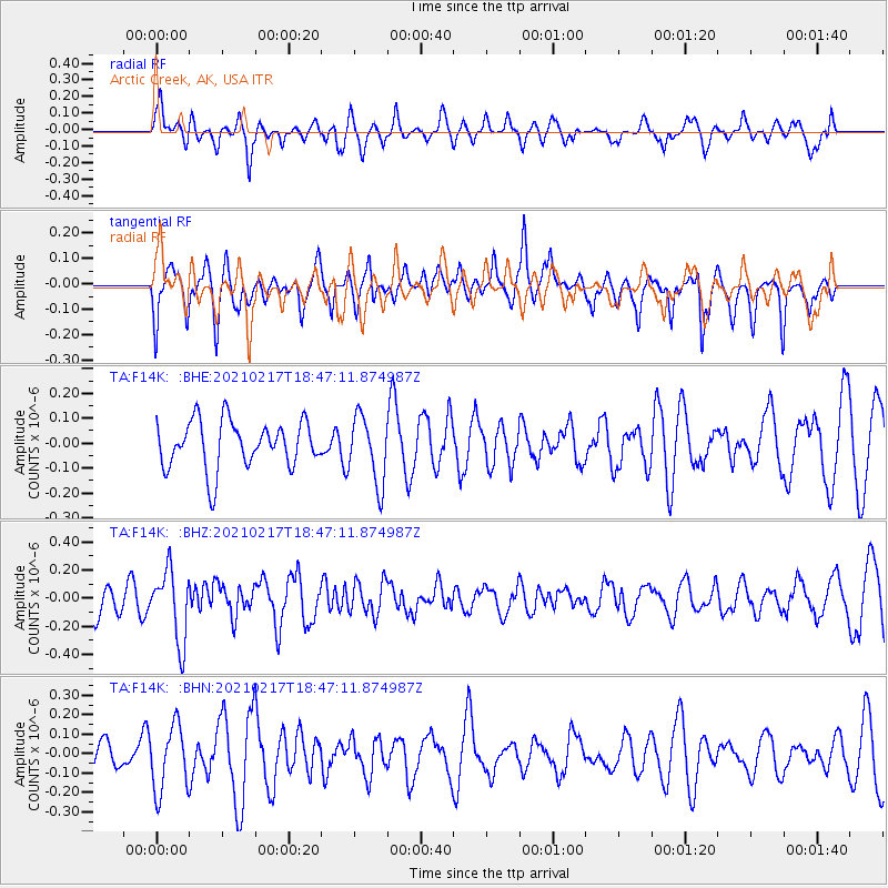
F14K Arctic Creek, AK, USA - Earthquake Result Viewer
*The percent match for this event was below the threshold and hence no stack was calculated.
| Earthquake location: |
Northern And Central Iran |
| Earthquake latitude/longitude: |
30.8/51.4 |
| Earthquake time(UTC): |
2021/02/17 (048) 18:35:35 GMT |
| Earthquake Depth: |
10 km |
| Earthquake Magnitude: |
5.4 Mww |
| Earthquake Catalog/Contributor: |
NEIC PDE/us |
|
| Network: |
TA USArray Transportable Network (new EarthScope stations) |
| Station: |
F14K Arctic Creek, AK, USA |
| Lat/Lon: |
65.47 N/166.33 W |
| Elevation: |
266 m |
|
| Distance: |
79.7 deg |
| Az: |
15.038 deg |
| Baz: |
327.674 deg |
| Ray Param: |
$rayparam |
*The percent match for this event was below the threshold and hence was not used in the summary stack. |
|
| Radial Match: |
51.79303 % |
| Radial Bump: |
400 |
| Transverse Match: |
64.87193 % |
| Transverse Bump: |
400 |
| SOD ConfigId: |
23341671 |
| Insert Time: |
2021-03-03 19:46:28.638 +0000 |
| GWidth: |
2.5 |
| Max Bumps: |
400 |
| Tol: |
0.001 |
|
Signal To Noise
| Channel | StoN | STA | LTA |
| TA:F14K: :BHZ:20210217T18:47:11.874987Z | 2.110858 | 2.5093846E-7 | 1.1887984E-7 |
| TA:F14K: :BHN:20210217T18:47:11.874987Z | 2.1286316 | 1.6895186E-7 | 7.937111E-8 |
| TA:F14K: :BHE:20210217T18:47:11.874987Z | 1.4228526 | 1.3458848E-7 | 9.45906E-8 |
| Arrivals |
| Ps | |
| PpPs | |
| PsPs/PpSs | |


