You are here: Home > Network List > US - United States National Seismic Network Stations List
> Station ERPA Erie, Pennsylvania, USA > Earthquake Result Viewer
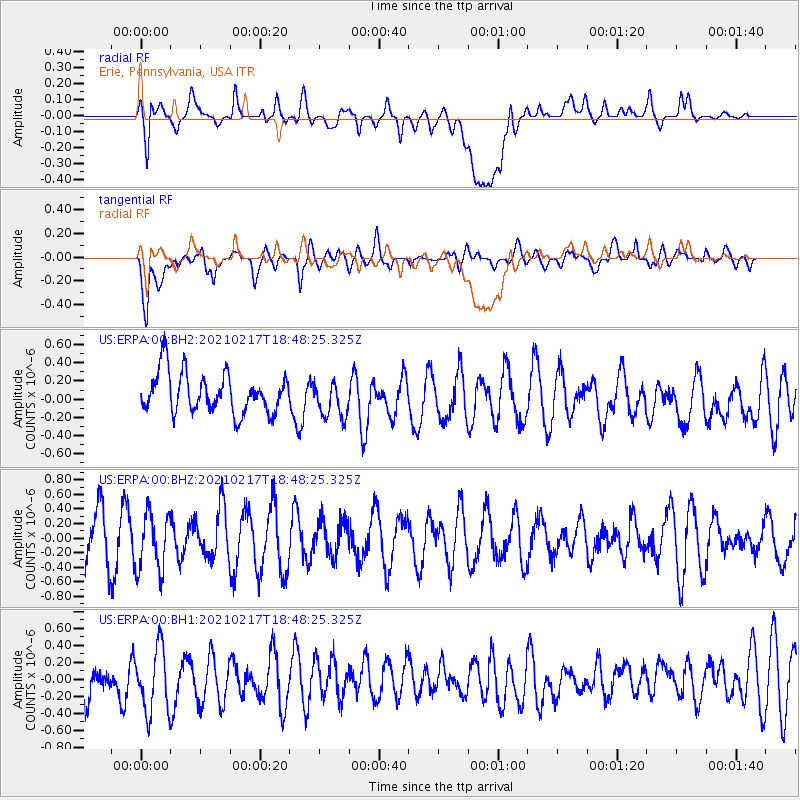
ERPA Erie, Pennsylvania, USA - Earthquake Result Viewer
*The percent match for this event was below the threshold and hence no stack was calculated.
| Earthquake location: |
Northern And Central Iran |
| Earthquake latitude/longitude: |
30.8/51.4 |
| Earthquake time(UTC): |
2021/02/17 (048) 18:35:35 GMT |
| Earthquake Depth: |
10 km |
| Earthquake Magnitude: |
5.4 Mww |
| Earthquake Catalog/Contributor: |
NEIC PDE/us |
|
| Network: |
US United States National Seismic Network |
| Station: |
ERPA Erie, Pennsylvania, USA |
| Lat/Lon: |
42.12 N/79.99 W |
| Elevation: |
306 m |
|
| Distance: |
94.7 deg |
| Az: |
325.922 deg |
| Baz: |
40.383 deg |
| Ray Param: |
$rayparam |
*The percent match for this event was below the threshold and hence was not used in the summary stack. |
|
| Radial Match: |
50.628033 % |
| Radial Bump: |
400 |
| Transverse Match: |
60.043396 % |
| Transverse Bump: |
400 |
| SOD ConfigId: |
23341671 |
| Insert Time: |
2021-03-03 19:47:27.988 +0000 |
| GWidth: |
2.5 |
| Max Bumps: |
400 |
| Tol: |
0.001 |
|
Signal To Noise
| Channel | StoN | STA | LTA |
| US:ERPA:00:BHZ:20210217T18:48:25.325Z | 1.2655034 | 3.9075928E-7 | 3.0877774E-7 |
| US:ERPA:00:BH1:20210217T18:48:25.325Z | 1.5120214 | 3.8668847E-7 | 2.5574272E-7 |
| US:ERPA:00:BH2:20210217T18:48:25.325Z | 0.92458385 | 2.0249735E-7 | 2.1901458E-7 |
| Arrivals |
| Ps | |
| PpPs | |
| PsPs/PpSs | |


