
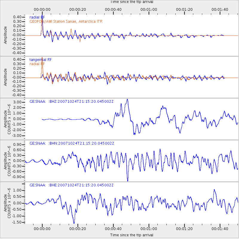
SNAA GEOFON/AWI Station Sanae, Antarctica - Earthquake Result Viewer
| ||||||||||||||||||
| ||||||||||||||||||
| ||||||||||||||||||
|
Signal To Noise
| Channel | StoN | STA | LTA |
| GE:SNAA: :BHN:20071024T21:15:20.045002Z | 1.8904037 | 1.1071028E-7 | 5.8564357E-8 |
| GE:SNAA: :BHE:20071024T21:15:20.045002Z | 3.0545874 | 1.7696314E-7 | 5.793357E-8 |
| GE:SNAA: :BHZ:20071024T21:15:20.045002Z | 7.5017967 | 4.5208E-7 | 6.026289E-8 |
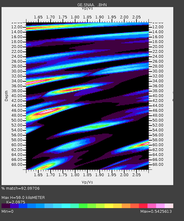
| Arrivals | |
| Ps | 10 SECOND |
| PpPs | 28 SECOND |
| PsPs/PpSs | 38 SECOND |

