You are here: Home > Network List > CI - Caltech Regional Seismic Network Stations List
> Station BFS Mt Baldy Forest Station > Earthquake Result Viewer
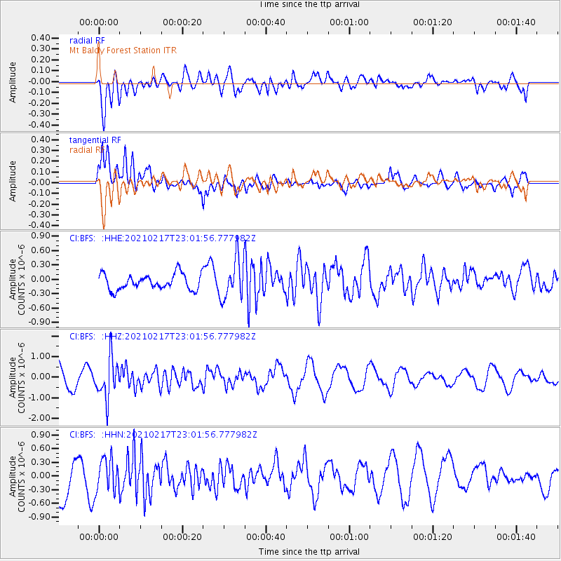
BFS Mt Baldy Forest Station - Earthquake Result Viewer
*The percent match for this event was below the threshold and hence no stack was calculated.
| Earthquake location: |
Southeast Of Loyalty Islands |
| Earthquake latitude/longitude: |
-23.2/171.8 |
| Earthquake time(UTC): |
2021/02/17 (048) 22:49:38 GMT |
| Earthquake Depth: |
13 km |
| Earthquake Magnitude: |
6.1 Mww |
| Earthquake Catalog/Contributor: |
NEIC PDE/us |
|
| Network: |
CI Caltech Regional Seismic Network |
| Station: |
BFS Mt Baldy Forest Station |
| Lat/Lon: |
34.24 N/117.66 W |
| Elevation: |
1312 m |
|
| Distance: |
88.0 deg |
| Az: |
51.424 deg |
| Baz: |
240.266 deg |
| Ray Param: |
$rayparam |
*The percent match for this event was below the threshold and hence was not used in the summary stack. |
|
| Radial Match: |
71.34135 % |
| Radial Bump: |
400 |
| Transverse Match: |
70.48682 % |
| Transverse Bump: |
400 |
| SOD ConfigId: |
23341671 |
| Insert Time: |
2021-03-03 23:58:32.288 +0000 |
| GWidth: |
2.5 |
| Max Bumps: |
400 |
| Tol: |
0.001 |
|
Signal To Noise
| Channel | StoN | STA | LTA |
| CI:BFS: :HHZ:20210217T23:01:56.777982Z | 1.8240211 | 9.723992E-7 | 5.331074E-7 |
| CI:BFS: :HHN:20210217T23:01:56.777982Z | 0.6713688 | 3.5093208E-7 | 5.227114E-7 |
| CI:BFS: :HHE:20210217T23:01:56.777982Z | 2.6281993 | 4.2490367E-7 | 1.6167101E-7 |
| Arrivals |
| Ps | |
| PpPs | |
| PsPs/PpSs | |


