You are here: Home > Network List > CI - Caltech Regional Seismic Network Stations List
> Station GMR Granite Mountains Research Center > Earthquake Result Viewer
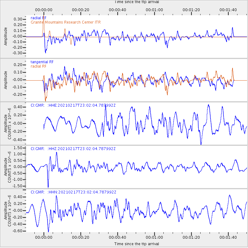
GMR Granite Mountains Research Center - Earthquake Result Viewer
*The percent match for this event was below the threshold and hence no stack was calculated.
| Earthquake location: |
Southeast Of Loyalty Islands |
| Earthquake latitude/longitude: |
-23.2/171.8 |
| Earthquake time(UTC): |
2021/02/17 (048) 22:49:38 GMT |
| Earthquake Depth: |
13 km |
| Earthquake Magnitude: |
6.1 Mww |
| Earthquake Catalog/Contributor: |
NEIC PDE/us |
|
| Network: |
CI Caltech Regional Seismic Network |
| Station: |
GMR Granite Mountains Research Center |
| Lat/Lon: |
34.78 N/115.66 W |
| Elevation: |
1326 m |
|
| Distance: |
89.7 deg |
| Az: |
51.753 deg |
| Baz: |
241.399 deg |
| Ray Param: |
$rayparam |
*The percent match for this event was below the threshold and hence was not used in the summary stack. |
|
| Radial Match: |
46.09567 % |
| Radial Bump: |
400 |
| Transverse Match: |
45.955814 % |
| Transverse Bump: |
400 |
| SOD ConfigId: |
23341671 |
| Insert Time: |
2021-03-03 23:58:53.003 +0000 |
| GWidth: |
2.5 |
| Max Bumps: |
400 |
| Tol: |
0.001 |
|
Signal To Noise
| Channel | StoN | STA | LTA |
| CI:GMR: :HHZ:20210217T23:02:04.787992Z | 2.7107122 | 5.331691E-7 | 1.9668967E-7 |
| CI:GMR: :HHN:20210217T23:02:04.787992Z | 2.0118651 | 3.1098915E-7 | 1.5457753E-7 |
| CI:GMR: :HHE:20210217T23:02:04.787992Z | 2.081476 | 2.3451086E-7 | 1.1266567E-7 |
| Arrivals |
| Ps | |
| PpPs | |
| PsPs/PpSs | |


