You are here: Home > Network List > CI - Caltech Regional Seismic Network Stations List
> Station GRA Grapevine Ranger Station, Death Valley, CA, USA > Earthquake Result Viewer
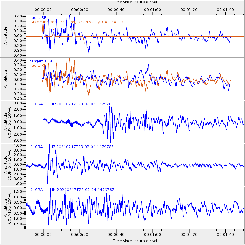
GRA Grapevine Ranger Station, Death Valley, CA, USA - Earthquake Result Viewer
*The percent match for this event was below the threshold and hence no stack was calculated.
| Earthquake location: |
Southeast Of Loyalty Islands |
| Earthquake latitude/longitude: |
-23.2/171.8 |
| Earthquake time(UTC): |
2021/02/17 (048) 22:49:38 GMT |
| Earthquake Depth: |
13 km |
| Earthquake Magnitude: |
6.1 Mww |
| Earthquake Catalog/Contributor: |
NEIC PDE/us |
|
| Network: |
CI Caltech Regional Seismic Network |
| Station: |
GRA Grapevine Ranger Station, Death Valley, CA, USA |
| Lat/Lon: |
37.00 N/117.37 W |
| Elevation: |
689 m |
|
| Distance: |
89.6 deg |
| Az: |
49.151 deg |
| Baz: |
240.389 deg |
| Ray Param: |
$rayparam |
*The percent match for this event was below the threshold and hence was not used in the summary stack. |
|
| Radial Match: |
66.0878 % |
| Radial Bump: |
400 |
| Transverse Match: |
33.42331 % |
| Transverse Bump: |
400 |
| SOD ConfigId: |
23341671 |
| Insert Time: |
2021-03-03 23:58:55.803 +0000 |
| GWidth: |
2.5 |
| Max Bumps: |
400 |
| Tol: |
0.001 |
|
Signal To Noise
| Channel | StoN | STA | LTA |
| CI:GRA: :HHZ:20210217T23:02:04.147978Z | 7.526357 | 1.5624266E-6 | 2.0759401E-7 |
| CI:GRA: :HHN:20210217T23:02:04.147978Z | 1.0277473 | 6.778347E-7 | 6.5953446E-7 |
| CI:GRA: :HHE:20210217T23:02:04.147978Z | 2.3497088 | 6.559736E-7 | 2.7917233E-7 |
| Arrivals |
| Ps | |
| PpPs | |
| PsPs/PpSs | |


