You are here: Home > Network List > CI - Caltech Regional Seismic Network Stations List
> Station GSC Goldstone, Goldstone Lake, CA, USA > Earthquake Result Viewer
GSC Goldstone, Goldstone Lake, CA, USA - Earthquake Result Viewer
*The percent match for this event was below the threshold and hence no stack was calculated.
| Earthquake location: |
Southeast Of Loyalty Islands |
| Earthquake latitude/longitude: |
-23.2/171.8 |
| Earthquake time(UTC): |
2021/02/17 (048) 22:49:38 GMT |
| Earthquake Depth: |
13 km |
| Earthquake Magnitude: |
6.1 Mww |
| Earthquake Catalog/Contributor: |
NEIC PDE/us |
|
| Network: |
CI Caltech Regional Seismic Network |
| Station: |
GSC Goldstone, Goldstone Lake, CA, USA |
| Lat/Lon: |
35.30 N/116.81 W |
| Elevation: |
1000 m |
|
| Distance: |
89.2 deg |
| Az: |
50.847 deg |
| Baz: |
240.736 deg |
| Ray Param: |
$rayparam |
*The percent match for this event was below the threshold and hence was not used in the summary stack. |
|
| Radial Match: |
73.057526 % |
| Radial Bump: |
400 |
| Transverse Match: |
48.02728 % |
| Transverse Bump: |
400 |
| SOD ConfigId: |
23341671 |
| Insert Time: |
2021-03-03 23:58:56.299 +0000 |
| GWidth: |
2.5 |
| Max Bumps: |
400 |
| Tol: |
0.001 |
|
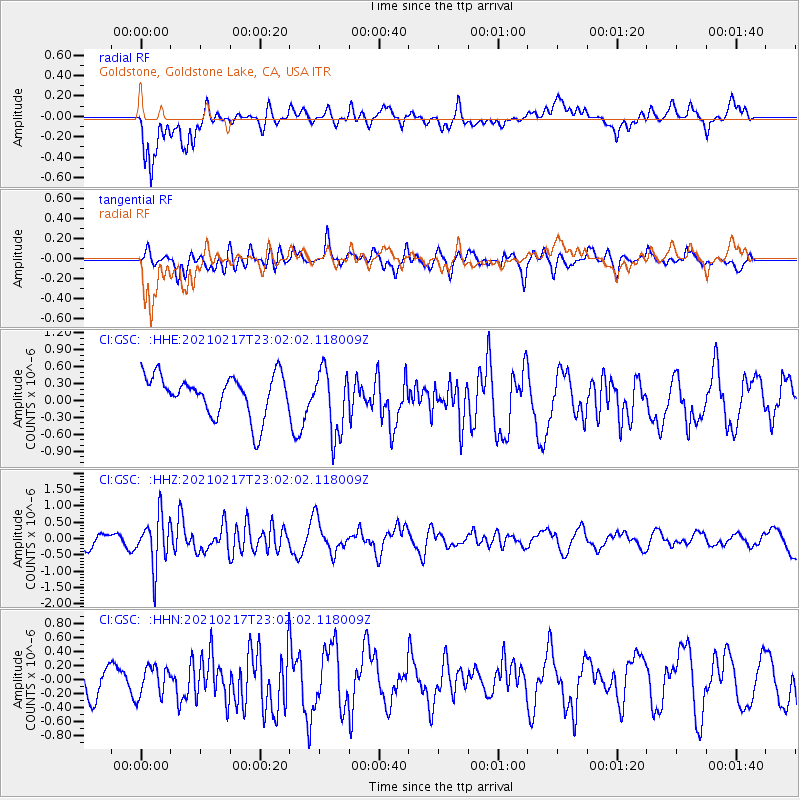
Signal To Noise
| Channel | StoN | STA | LTA |
| CI:GSC: :HHZ:20210217T23:02:02.118009Z | 2.0733552 | 7.694213E-7 | 3.7109962E-7 |
| CI:GSC: :HHN:20210217T23:02:02.118009Z | 0.62551457 | 2.1405317E-7 | 3.4220335E-7 |
| CI:GSC: :HHE:20210217T23:02:02.118009Z | 1.6235121 | 5.802782E-7 | 3.574215E-7 |
| Arrivals |
| Ps | |
| PpPs | |
| PsPs/PpSs | |


