You are here: Home > Network List > CI - Caltech Regional Seismic Network Stations List
> Station SLA SLA, Trona, CA, USA > Earthquake Result Viewer
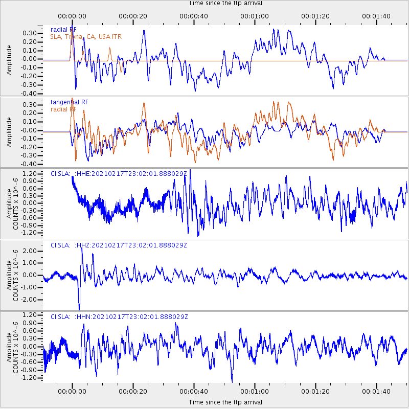
SLA SLA, Trona, CA, USA - Earthquake Result Viewer
*The percent match for this event was below the threshold and hence no stack was calculated.
| Earthquake location: |
Southeast Of Loyalty Islands |
| Earthquake latitude/longitude: |
-23.2/171.8 |
| Earthquake time(UTC): |
2021/02/17 (048) 22:49:38 GMT |
| Earthquake Depth: |
13 km |
| Earthquake Magnitude: |
6.1 Mww |
| Earthquake Catalog/Contributor: |
NEIC PDE/us |
|
| Network: |
CI Caltech Regional Seismic Network |
| Station: |
SLA SLA, Trona, CA, USA |
| Lat/Lon: |
35.89 N/117.28 W |
| Elevation: |
1174 m |
|
| Distance: |
89.1 deg |
| Az: |
50.143 deg |
| Baz: |
240.449 deg |
| Ray Param: |
$rayparam |
*The percent match for this event was below the threshold and hence was not used in the summary stack. |
|
| Radial Match: |
63.061363 % |
| Radial Bump: |
400 |
| Transverse Match: |
38.06726 % |
| Transverse Bump: |
400 |
| SOD ConfigId: |
23341671 |
| Insert Time: |
2021-03-03 23:59:35.739 +0000 |
| GWidth: |
2.5 |
| Max Bumps: |
400 |
| Tol: |
0.001 |
|
Signal To Noise
| Channel | StoN | STA | LTA |
| CI:SLA: :HHZ:20210217T23:02:01.888029Z | 4.247786 | 1.0359865E-6 | 2.438886E-7 |
| CI:SLA: :HHN:20210217T23:02:01.888029Z | 1.1132181 | 4.615536E-7 | 4.1461203E-7 |
| CI:SLA: :HHE:20210217T23:02:01.888029Z | 1.268555 | 4.5099773E-7 | 3.5552085E-7 |
| Arrivals |
| Ps | |
| PpPs | |
| PsPs/PpSs | |


