You are here: Home > Network List > TA - USArray Transportable Network (new EarthScope stations) Stations List
> Station D23K Nanushuk River, AK USA > Earthquake Result Viewer
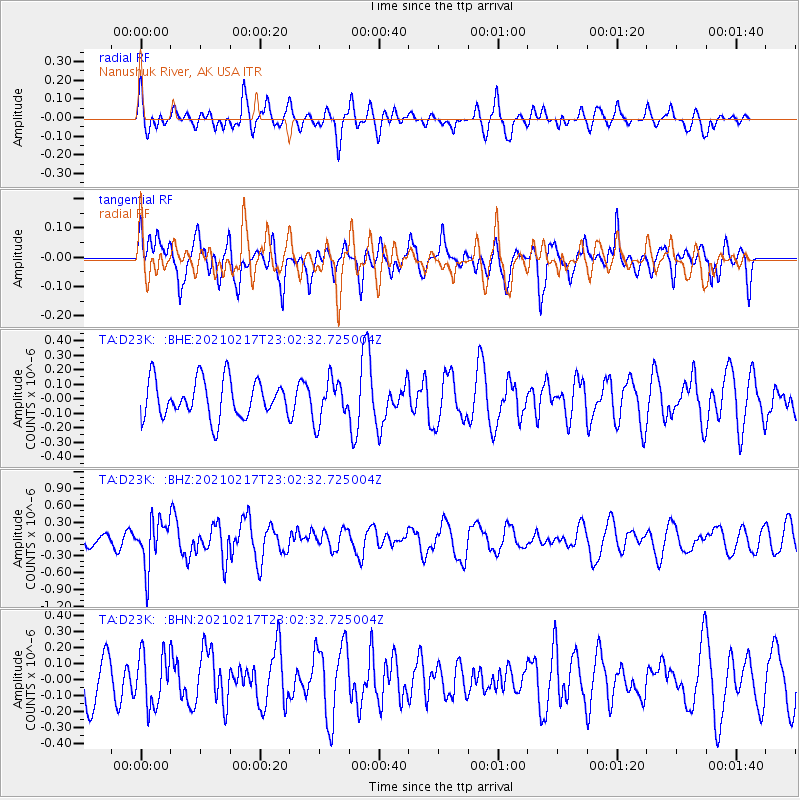
D23K Nanushuk River, AK USA - Earthquake Result Viewer
*The percent match for this event was below the threshold and hence no stack was calculated.
| Earthquake location: |
Southeast Of Loyalty Islands |
| Earthquake latitude/longitude: |
-23.2/171.8 |
| Earthquake time(UTC): |
2021/02/17 (048) 22:49:38 GMT |
| Earthquake Depth: |
13 km |
| Earthquake Magnitude: |
6.1 Mww |
| Earthquake Catalog/Contributor: |
NEIC PDE/us |
|
| Network: |
TA USArray Transportable Network (new EarthScope stations) |
| Station: |
D23K Nanushuk River, AK USA |
| Lat/Lon: |
68.97 N/150.68 W |
| Elevation: |
406 m |
|
| Distance: |
95.8 deg |
| Az: |
12.781 deg |
| Baz: |
214.323 deg |
| Ray Param: |
$rayparam |
*The percent match for this event was below the threshold and hence was not used in the summary stack. |
|
| Radial Match: |
51.473675 % |
| Radial Bump: |
400 |
| Transverse Match: |
46.452377 % |
| Transverse Bump: |
400 |
| SOD ConfigId: |
23341671 |
| Insert Time: |
2021-03-04 00:04:53.145 +0000 |
| GWidth: |
2.5 |
| Max Bumps: |
400 |
| Tol: |
0.001 |
|
Signal To Noise
| Channel | StoN | STA | LTA |
| TA:D23K: :BHZ:20210217T23:02:32.725004Z | 3.1999466 | 4.152393E-7 | 1.2976444E-7 |
| TA:D23K: :BHN:20210217T23:02:32.725004Z | 1.3408426 | 1.6557846E-7 | 1.2348836E-7 |
| TA:D23K: :BHE:20210217T23:02:32.725004Z | 1.0889264 | 1.4100131E-7 | 1.2948654E-7 |
| Arrivals |
| Ps | |
| PpPs | |
| PsPs/PpSs | |


