You are here: Home > Network List > TA - USArray Transportable Network (new EarthScope stations) Stations List
> Station F14K Arctic Creek, AK, USA > Earthquake Result Viewer
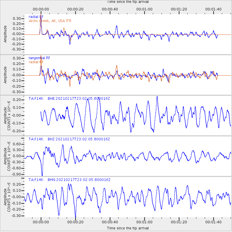
F14K Arctic Creek, AK, USA - Earthquake Result Viewer
*The percent match for this event was below the threshold and hence no stack was calculated.
| Earthquake location: |
Southeast Of Loyalty Islands |
| Earthquake latitude/longitude: |
-23.2/171.8 |
| Earthquake time(UTC): |
2021/02/17 (048) 22:49:38 GMT |
| Earthquake Depth: |
13 km |
| Earthquake Magnitude: |
6.1 Mww |
| Earthquake Catalog/Contributor: |
NEIC PDE/us |
|
| Network: |
TA USArray Transportable Network (new EarthScope stations) |
| Station: |
F14K Arctic Creek, AK, USA |
| Lat/Lon: |
65.47 N/166.33 W |
| Elevation: |
266 m |
|
| Distance: |
90.0 deg |
| Az: |
8.961 deg |
| Baz: |
200.083 deg |
| Ray Param: |
$rayparam |
*The percent match for this event was below the threshold and hence was not used in the summary stack. |
|
| Radial Match: |
65.97313 % |
| Radial Bump: |
395 |
| Transverse Match: |
41.699837 % |
| Transverse Bump: |
400 |
| SOD ConfigId: |
23341671 |
| Insert Time: |
2021-03-04 00:05:00.206 +0000 |
| GWidth: |
2.5 |
| Max Bumps: |
400 |
| Tol: |
0.001 |
|
Signal To Noise
| Channel | StoN | STA | LTA |
| TA:F14K: :BHZ:20210217T23:02:05.800016Z | 4.116373 | 4.2462324E-7 | 1.03154704E-7 |
| TA:F14K: :BHN:20210217T23:02:05.800016Z | 0.8862432 | 8.623498E-8 | 9.730396E-8 |
| TA:F14K: :BHE:20210217T23:02:05.800016Z | 1.8669996 | 1.524968E-7 | 8.1680135E-8 |
| Arrivals |
| Ps | |
| PpPs | |
| PsPs/PpSs | |


