You are here: Home > Network List > TA - USArray Transportable Network (new EarthScope stations) Stations List
> Station L29M Grand Valley Creek, YT, CAN > Earthquake Result Viewer
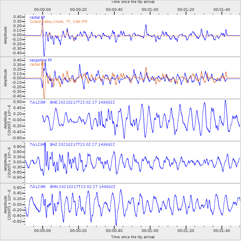
L29M Grand Valley Creek, YT, CAN - Earthquake Result Viewer
*The percent match for this event was below the threshold and hence no stack was calculated.
| Earthquake location: |
Southeast Of Loyalty Islands |
| Earthquake latitude/longitude: |
-23.2/171.8 |
| Earthquake time(UTC): |
2021/02/17 (048) 22:49:38 GMT |
| Earthquake Depth: |
13 km |
| Earthquake Magnitude: |
6.1 Mww |
| Earthquake Catalog/Contributor: |
NEIC PDE/us |
|
| Network: |
TA USArray Transportable Network (new EarthScope stations) |
| Station: |
L29M Grand Valley Creek, YT, CAN |
| Lat/Lon: |
63.11 N/138.13 W |
| Elevation: |
918 m |
|
| Distance: |
94.6 deg |
| Az: |
20.489 deg |
| Baz: |
225.099 deg |
| Ray Param: |
$rayparam |
*The percent match for this event was below the threshold and hence was not used in the summary stack. |
|
| Radial Match: |
52.85341 % |
| Radial Bump: |
400 |
| Transverse Match: |
67.84098 % |
| Transverse Bump: |
400 |
| SOD ConfigId: |
23341671 |
| Insert Time: |
2021-03-04 00:05:26.499 +0000 |
| GWidth: |
2.5 |
| Max Bumps: |
400 |
| Tol: |
0.001 |
|
Signal To Noise
| Channel | StoN | STA | LTA |
| TA:L29M: :BHZ:20210217T23:02:27.149992Z | 3.2202163 | 4.9065534E-7 | 1.523672E-7 |
| TA:L29M: :BHN:20210217T23:02:27.149992Z | 1.0957724 | 2.009887E-7 | 1.8342195E-7 |
| TA:L29M: :BHE:20210217T23:02:27.149992Z | 1.1094716 | 1.6428123E-7 | 1.480716E-7 |
| Arrivals |
| Ps | |
| PpPs | |
| PsPs/PpSs | |


