You are here: Home > Network List > US - United States National Seismic Network Stations List
> Station HAWA Hanford, Washington, USA > Earthquake Result Viewer
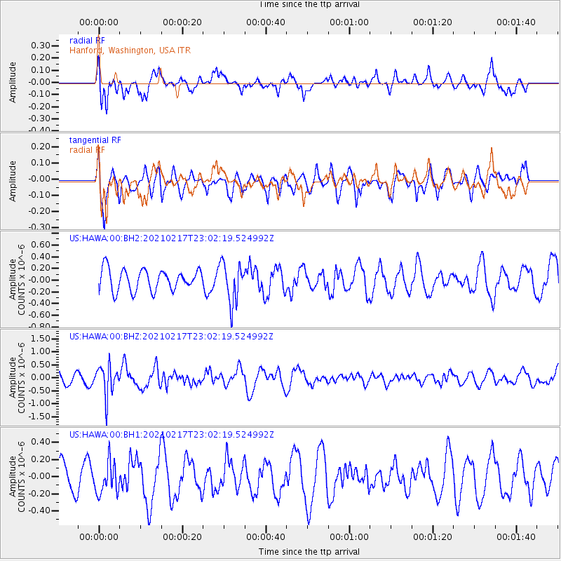
HAWA Hanford, Washington, USA - Earthquake Result Viewer
*The percent match for this event was below the threshold and hence no stack was calculated.
| Earthquake location: |
Southeast Of Loyalty Islands |
| Earthquake latitude/longitude: |
-23.2/171.8 |
| Earthquake time(UTC): |
2021/02/17 (048) 22:49:38 GMT |
| Earthquake Depth: |
13 km |
| Earthquake Magnitude: |
6.1 Mww |
| Earthquake Catalog/Contributor: |
NEIC PDE/us |
|
| Network: |
US United States National Seismic Network |
| Station: |
HAWA Hanford, Washington, USA |
| Lat/Lon: |
46.39 N/119.53 W |
| Elevation: |
364 m |
|
| Distance: |
92.9 deg |
| Az: |
40.222 deg |
| Baz: |
239.147 deg |
| Ray Param: |
$rayparam |
*The percent match for this event was below the threshold and hence was not used in the summary stack. |
|
| Radial Match: |
61.572403 % |
| Radial Bump: |
400 |
| Transverse Match: |
44.1526 % |
| Transverse Bump: |
400 |
| SOD ConfigId: |
23341671 |
| Insert Time: |
2021-03-04 00:07:07.665 +0000 |
| GWidth: |
2.5 |
| Max Bumps: |
400 |
| Tol: |
0.001 |
|
Signal To Noise
| Channel | StoN | STA | LTA |
| US:HAWA:00:BHZ:20210217T23:02:19.524992Z | 3.364619 | 5.8221354E-7 | 1.7303996E-7 |
| US:HAWA:00:BH1:20210217T23:02:19.524992Z | 1.0953138 | 1.860166E-7 | 1.6982952E-7 |
| US:HAWA:00:BH2:20210217T23:02:19.524992Z | 1.9084657 | 3.4397354E-7 | 1.8023565E-7 |
| Arrivals |
| Ps | |
| PpPs | |
| PsPs/PpSs | |


